INTERNATIONAL FIELD SCHOOLS A-F
ARMENIA
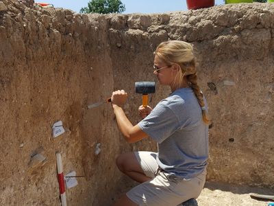
Tavush Excavation & Survey: Pleistocene behavioral landscape of northern Armenia
Dates: June 26 to August 4, 2025
Project website: https://ifrglobal.org/program/armenia-tavush-excavation-survey/
Project syllabus: https://ifrglobal.org/wp-content/uploads/2024/12/Syllabus-Armenia-Tavush-2025.docx-Google-Docs.pdf
Overview
在
Field school highlights:
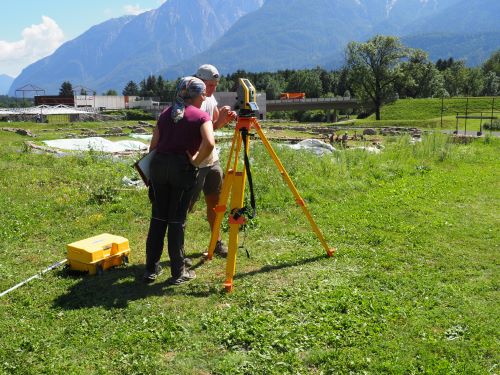
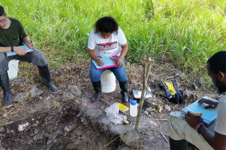
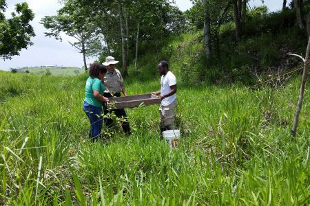
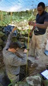
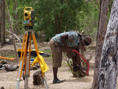
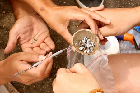
- Gain skills in essential archaeological techniques, including excavation, surveying, digital geospatial recording, stratigraphic interpretation, and the use of a total station
- Work alongside a team of international experts to reconstruct past environments and analyze changes in hominin technology and site use over time
- Connect with rural Armenian life! Participate in cultural festivals and visit historical landmarks in the Tavush Province and nearby Georgia as part of your program
OVERVIEW
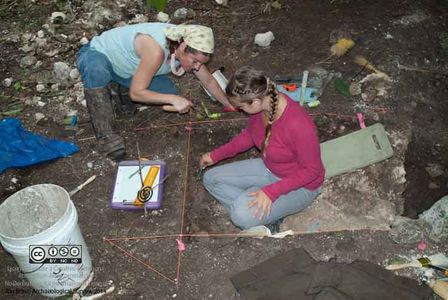
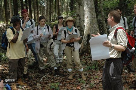
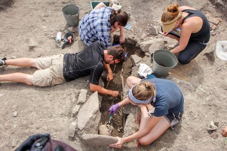
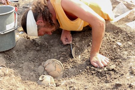
The goal of this field project is to expand our understanding of hominin occupation and behavior in the Armenian Highlands and southern Caucasus during the Late Pleistocene via geological and archaeological research in the Debed Gorge in the Tavush Province of northern Armenia. We aim to a) produce a regional chronological sequence of Middle Palaeolithic (MP) sites in the Debed Gorge, b) correlate the sedimentary sequences exposed at these sites, c) reconstruct local Pleistocene environments and climates, especially during the understudied Marine Isotope Stage 5, d) clarify technological sequences during the Late Pleistocene of this region, and e) reconstruct site level spatial behaviors. These objectives will be accomplished by a) continuing geoarchaeological excavations and dating work at Ptghavan-4 (PTV-4), b) redating and reanalysis of the site of Bagratashen-1 (BGN-1), and c) survey for and testing of new sites.
PT
Th
COURSE OBJECTIVES
This course aims to introduce students to the practice of field research in Pleistocene geoarchaeology. By the end of the course, students will be proficient in the application of best practices in geoarchaeological research. This will be achieved through:
- Introducing students to archaeological research design through discussions on the scientific method, adaptive decision making in the field, and data interpretation.
- Providing students with hands on experience with basic field methods, including, but not limited to, establishing a grid, hand excavation techniques, sample collection, and sieving (wet/dry).
- Training students in field documentation techniques, including, but not limited to, written records (field journals, labels, etc.), field photography, field illustration, hand measurements, GPS, and total stations.
- Exposing students to the importance of stratigraphy, sedimentology, and context through training in basic sediment and soil identification, geospatial data collection, and geological sampling techniques.
- Training students in basic field lab procedures, including, but not limited to, find processing, cleaning, organizing, technical artefact drawing, basic artefact analysis, long term storage solutions, 3D scanning, data conservation, and artefact conservation.
- Providing opportunities for students to become more actively involved in the research of specialists both in the field and after the conclusion of the season. This includes projects on lithic analysis, 3D scanning, bulk sedimentology, geoarchaeology, zooarchaeology, dating, micromorphology, phytoliths, palynology, plant waxes, and more.
- Introducing students to the Middle Palaeolithic of the Armenian Highlands and southern Caucasus through readings, lectures, and field discussions.
- Introducing students to the culture and history of Armenia and Georgia through direct experience living and working with Armenians and visits to various sites and cultural locations.
FIELD SCHOOL DIRECTOR: Dr. Jayson P. Gill, Archaeology Program, Wesleyan University (jgill@wesleyan.edu)
ARMENIA
ARCHAEOLOGICAL FIELD SCHOOL IN ARMENIAN PREHISTORY (Debed Gorge, Armenia)
Dates: July 1 to August 1, 2025 Application deadline: Feb. 2, 2025
Project website: https://app.studyabroad.uconn.edu/index.cfm?FuseAction=Programs.ViewProgramAngular&id=10386
Project syllabus: https://ifrglobal.org/wp-content/uploads/2024/12/Syllabus-Armenia-Tavush-2025.docx-Google-Docs.pdf
Overview
Experience UConn’s Archaeological Field School in Armenian Prehistory, running from July 1st-August 1st, 2025! Apply now through UConn Experiential Global Learning. Applications are due February 1st, 2025.
Students will participate in geoarchaeological excavations and environmental reconstruction work at several Stone Age sites in Armenia that document a variety of important milestones in human biological, cognitive, and cultural evolution. Fieldwork will focus on excavations at Ptghavan-4, a Late Pleistocene open-air site in northern Armenia dated to roughly 100,000 years ago. In addition, students will participate in archaeological survey of the Debed Gorge, testing of other sites, and basic lab work.
Students will be trained in a variety of field and laboratory methods, including geoarchaeological excavation, digital geospatial recording, stratigraphic interpretation, environmental sampling, and artifact processing and curation.
Through this program, you will gain an exciting hands-on perspective on human evolution and archaeology, and the chance to experience a rich and vibrant culture, while working side by side with a team of international experts and Armenian scholars.
How to Apply
Please read all information on this brochure carefully, including all of the information in the tabs above. When you are ready, meet with your Experiential Global Learning Advisor to discuss what questions you may have and learn more about the application process. You may find your advisor using the Our Team page.
Students will receive six (6) honors credits and students from any major are welcome to apply. For any questions, feel free to reach out to Dr. Gill at jayson.gill@uconn.edu or jgill@wesleyan.edu.
AUSTRIA
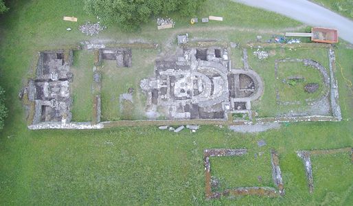
AGUNTUM ARCHAEOLOGICAL FIELD SCHOOL 2025: Excavations of an Alpine Roman Town (Aguntum, Römerstraße, Dölsach, Austria)
Dates: July 6 to August 2, 2025 Application Deadline: April 4, 2025
Project website: https://www.fieldsciences.org/program/2025-austria-aguntum/
Project syllabus: https://www.fieldsciences.org/wp-content/uploads/2024/10/Syllabus-Austria-Aguntum-2025.pdf
OVERVIEW
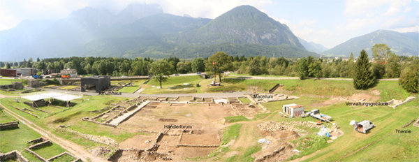 The Roman town of Aguntum was rediscovered in the early 20th century. Through decades of research, a Roman domus (private family residence of palatial proportions), impressive thermal baths, city walls, and numerous residential buildings were identified and excavated. Since 2006, ongoing excavations have been focused on the heart of the town—the forum area. The latest findings and analysis of artifacts suggest a flourishing Mediterranean city nestled amidst the Alpine landscape.
A large number of fragmented rock crystals were recovered from the city center. These findings offer insights into an extensive trade network, showcasing Aguntum as the sole known Roman hub for this coveted, high value resource material that were highly desired in ancient times. The presence of these artifacts indicates Aguntum’s status as a pivotal transshipment center, where commerce and cultural exchange converged.
From the 3rd century CE onwards, significant transformations in the urban layout of the town took place, as the former administrative hub transitioned into a residential and commercial zone. Throughout the 4th century CE, archaeological evidence indicates the emergence of various workshops and modest dwellings, reflecting a shift in the town’s function. By the end of the 4th and early in the 5th centuries CE, evidence of residences and workshops decrease, hinting at a decline in activity and importance of Aguntum.
By the 6th century CE, Aguntum is in ruins. The area now serves as burial grounds, suggesting a substantial abandonment of the settlement. These funerary discoveries shed light on the dwindling population and the gradual abandonment of Aguntum during this era.
Our research is focused on the social and economic mechanisms that powered this small Alpine town during the years of its existence. What motivated its establishment? How did Aguntum thrived and prospered during the first three centuries CE? Why did Aguntum’s power, trade and commerce declined and what brought to its final demise?
Director: MARTIN AUER martin.auer@uibk.ac.at Senior Scientist & Aguntum Site Director, University of Innsbruck (Austria)
THE BALKANS
BALKAN HERITAGE FIELD SCHOOL:
Field School Programs in Archaeology and Historic Preservation
Date: Summer 2025 information about a wide variety of excavation and conservation projects can be found at https://www.bhfieldschool.org/
(Note: various excavation and conservation projects organized by the Balkan Heritage Field School are listed under their individual country locations below)
Website: https://www.bhfieldschool.org/about/about-us
OVERVIEW
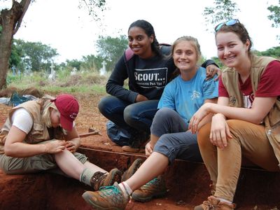
Balkan Heritage Field School (BHFS)is a program of the Balkan Heritage Foundation(BHF) intended for education in the field of archaeology and historic preservation and is targeted towards students and specialists, but also for anyone (18+) interested in cultural heritage study and preservation. BHF is а Bulgarian public, non-profit, non-governmental organization. It was established in 2008 by Ivan Vassilev, Nayden Prahov and Angela Pencheva with the mission of supporting the study, preservation and promotion of the cultural heritage of Southeastern Europe. In the period 2008 – 2019, BHF conducted and supported numerous projects related to archaeological research and excavations, conservation and recording of cultural monuments and artifacts, training and education in the field of cultural heritage, volunteer workcamps, exhibitions, conferences, public lectures, fundraising campaigns, and design of strategic plans for utilization of cultural heritage by municipalities.
BHFS first started in 2003 and resumed as the BHF program in 2008. It includes field school programs, taught in English, in four Balkan countries:Bulgaria, Greece, Montenegroandthe Republic of North Macedonia. All the field schools are affiliated with ongoing research and/or conservation projects: archaeological excavations, art historical expeditions, conservation of artifacts and monuments, thus contributing to the study and preservation of the cultural heritage of the Balkans. Since 2008, BHFS has implemented116 field school projects(with durations ranging from 1 to 8 weeks) attended byapprox. 2000 studentsfromover 60 countries* and involved a great number of academic and research institutions, museums, and heritage specialists from Bulgaria, the Republic of North Macedonia, USA, Canada, UK, Germany, Belgium, Greece, France, Montenegro and Japan.
The BHFS overall goal has been the development and enhancement of accessible practice-based education in the fields of archaeology and heritage conservation with an emphasis on Balkan cultural heritage. It aims to:
- supplement the academic education, volunteer training, and pre- and early career training through short-term practice-based field schools;
- encourage the involvement of students, scholars and volunteers in studies, preservation and promotion of Balkan cultural heritage;
- support research and conservation projects related to cultural heritage in SE Europe;
- promote and present Balkan cultural heritage worldwide;
- contribute to the sustainable development through utilization of cultural heritage for education and enhancement of cultural tourism in SE Europe; and
- foster the sensibilisation of local communities towards cultural heritage.
Each BHFS project combines 3 basic educational modules: theoretical (lectures, presentations and field training), practical (participation in excavations, lab work, conservation workshops, field trips) and excursions to attractive archaeological and cultural sites & behind-the-scene visits.
Currently there are three types of field school programs offered by BHFS:
- Archaeological field schoolstake place at different excavation sites (including underwater) related to all major cultures and civilizations that once existed in the Balkans, starting with the first Neolithic farmers in Europe and Europe’s first civilization in the Chalcolithic, followed by the Ancient Greek, Thracian, Roman, Byzantine, Bulgarian, and Ottoman civilizations.
- The emphasis in theworkshops on historic preservation/heritage conservationis on ancient Greek pottery, Roman pottery and glassware, mosaics and wall-paintings, historic metal, paper and textiles.
- In addition, an expedition introduces students to Late and Post Medieval (Byzantine) ecclesiastical architecture and wall-paintings.
Since 2014, BHFS has offered a thematic combination of certain projects as BHFS project packs providing more comprehensive educational opportunities, broader experience, extra excursions and tempting admission fee discounts.
Three universities award academic credits to students who participate in BHFS projects: New Bulgarian University, Bulgaria; Queen’s University, Canada and Connecticut College, through Institute for Field Research, USA. Participants who are not interested in academic credits are not expected to pay any tuition fee nor to take part in any activities related to academic curriculum (exams, academic reports etc.).
Our Mission
BHFS is not only a school but also a platform for solidarity in benefit of cultural heritage. Based on this, BHFS students, heritage specialists, partnering institutions and local communities interact and collaborate with each other benefiting as follows:
- BHFS students learn from professionals while taking part in real ongoing cultural heritage projects, travel to many historical & archaeological sites in the Balkans, gain intercultural experience and new friends, establish contacts receive academic credits.
- Heritage specialists (archaeologists, conservators, architects, art historians, etc.)and partner institutions (museums, research institutes, municipalities, NGOs, etc.) involved with BHFS receive additional funding & support for their work.
- Local communities, where BHFS projects take place, obtain new income, seasonal jobs, new perspectives about the local heritage, and increased promotion of the local tourist potential worldwide.
Considering this, we are always happy to inform each participant in any of our projects that joining the BHFS s/he becomes not only a student, but also:
- Volunteer in either a scientific research or a conservation-restoration project;
- Sponsor of the local economic growth;
- Benefactor to the local cultural heritage.
BELIZE
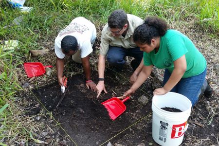
Maya Archaeology Field School in Belize (La Milpa Archaeological Site, Belize)
Dates: June 12-July 6, 2025 Application deadline: Jan. 29, 2025
Cost: $3,630.00 Total Cost-Includes Program cost and Tuition for 6 credits
Course Offerings:
ANTH 497 Maya Archaeology Filed School in Belize (Must have completed ANTH 107), 6 credits at $180/credit $1,080.00 Total for Credits.
Project Description:
The Tzaman Acropolis Research Project (TARP) at La Milpa is located within the Programme for Belize conservation area, a 260,000-acre nature reserve in northwestern Belize. The research area is home to over 80 known ancient Maya sites, many rare birds, two species of monkeys, jaguars, and other fauna and flora of the tropics.
This is a 6 credit-hour course designed to introduce students to the methods used to collect and analyze archaeological data in a hands-on field setting. The course will take place over the span of 4 weeks at a remote archaeological field camp in Belize, Central America. Students will receive instruction in archaeological excavations, making technical drawings, survey and instrument mapping, and basic field laboratory procedures at the ancient Maya urban center of La Milpa. In addition, students will have the opportunity to learn about the Prehispanic Maya through lectures and field trips.
During this unique program you will spend four weeks living and working in a professional archaeological camp in northwestern Belize. This is an intense program, during which you will spend 6 days/week excavating and participating in related activities at the ancient Maya city of La Milpa. The program is an experience you will remember for years as it provides not only a tremendous learning experience but also an opportunity for personal growth and exposure to the culture of the Latin American/Caribbean area.
Through hands on experience, you will learn the general aspects of field archaeology: excavation, survey, mapping, artifact processing, and artifact analysis.
Education is through a hands-on practical course that will require strenuous physical activity and manual dexterity. Field and lab training will be supplemented by occasional lectures, but most of the course is practical. All project participants will have the opportunity to participate in various aspects of archaeological fieldwork.
TARP operates under a permit issued through the Institute of Archaeology to Dr. Rissa Trachman, Director of the Programme for Belize Archaeology Project (PfBAP).
The field school dates are June 12-July 6, 2025.
Program fees cover the cost of room & board, and the group will be staying in the R.E.W. Adams Research Station. We will be sharing the camp with field schools from across the United States providing participants the opportunity to meet and interact with students and researchers from a wide range of backgrounds.
The Adams Research Station includes a lab, kitchen & dining hall, dorm building and platforms for tents. Students will have the option of sharing a tent with one person, or a dorm room with 3 other individuals.
The cost of the program is $2550 which includes:
- Room and board while in camp.
- Project-related ground transportation
- Laundry service once per week
- Use of necessary field equipment and supplies
- Operational and administrative costs and fees
- Weekend field trips to archaeological sites
For more information, contact:
Project Director:
Dr. David M. Hyde, 1 Western Way, Western Colorado University, Gunnison, Colorado 81231 dhyde@western.edu Phone: (970) 943-2222
Room and Board Arrangements:
Program fees cover the cost of room and board, and the group will be staying in the R.E.W. Adams Research Station. We will be sharing the camp with field schools from across the United States providing participants the opportunity to meet and interact with students and researchers from a wide range of backgrounds. The Adams Research Station includes a lab, kitchen & dining hall, dorm building and platforms for tents. Students will have the option of sharing a tent with one person, or a dorm room with 3 other individuals. The cost of the program is $2550 which includes: • Room and board while in camp. • Project-related ground transportation • Laundry service once per week • Use of necessary field equipment and supplies • Operational and administrative costs and fees • Weekend field trips to archaeological sites
Academic Credit:
6-Credit course offered through Western Colorado University. Course Offered: ANTH 497
BELIZE
Maya Archaeology, Belize: Dos Hombres Archaeological Project (Blue Creek, Orange Walk, Belize)
Dates: May 15 to June 8, 2025, with an optional 4-day trip at end (June 8-12, 2025).
Application Deadline: Feb. 7, 2025
Project website: https://facstaff.elon.edu/rtrachman/
Project video: https://vimeo.com/70281982
Th
About the field school
Students will be participating in original archaeological field research with Dr. Trachman from Elon University at the site of Dos Hombres, Belize. The field school format ensures students will have the academic rigor of learning about archaeological field methods, and ancient Maya culture, along with the experience and excitement of real archaeological discovery.
Field school students will stay in the R.E.W. Adams Research Facility (the archaeology camp) situated in a conservation and management area that is somewhat remote. The Rio Bravo Conservation and Management Area (RBCMA) is located in northwestern Belize and is comprised of 250,000 acres of protected tropical forest. As a result, students have a very unique opportunity to experience life in a communal/cooperative camp setting. Water, electricity, and the usual comforts of home are limited at best and many of them, such as TV and internet, are not available in camp.
Physical Requirements: Students will be required to participate in every aspect of the archaeological fieldwork conducted during the research of the archaeological site, both in the field and in the field laboratory. In order to participate in the daily fieldwork, students will need to be physically able to hike one hour each day in order to access the site. Also, many of the site tours will require this same physical ability. Summer in Belize is the rainy season and the climate ranges from hot and humid to cool and rainy. Students should anticipate both kinds of weather and should drink plenty of water at all times. The first day of the field school will be devoted to acclimating (by drinking several liters of water) and orientations.
罗依
BELIZE
Blue Creek Archaeological Project: Field School
Dates: June 2 to July 13, 2025
Project website: http://www.mayaresearchprogram.org/styled-4/Excavate%20a%20Maya%20city.html
Informational flyer (from summer 2024): https://drive.google.com/file/d/1Sg0Xj-HMmV7nSGBbiMXklZ08vS7SYF2K/view
OVERVIEW
The Maya Research Program (MRP) is a non-profit organization (501 C3) that sponsors archaeological and ethnographic research in Middle America. Each summer since 1992, MRP has supported archaeological research in northwestern Belize. The Blue Creek Archaeological Project includes research at the sites of Blue Creek, Grey Fox, Nojol Nah, Tulix Mul, Tz’unun, and Xnoha, (You can read many MRP publicationshere.)
MRP has been instrumental in documenting and protecting numerous Maya sites in northwestern Belize. Over 3000 students and volunteers have participated in the project in the past 29 years. The current Blue Creek project team includes faculty members and graduate students from over a dozen universities worldwide and is affiliated with the University of Texas at Tyler.
The summer of 2025 marks MRP’s Blue Creek Archaeological Project’s 30th archaeological field season in northwestern Belize. MRP is proud to support a vast range of talented researchers from across the globe under this project’s umbrella. Our research associates include not only archaeologists, but also accomplished professionals in fields such as soil science, geoarchaeology, geography, conservation, bioarchaeology, botany, and anthropology.
From June to July, MRP hosts multiple two-week sessions for students and volunteers at Blue Creek. The MRP general field school provides participants with hands-on training in the fundamentals of archaeological field techniques. Participants will gain training and experience in archaeological excavation methods, manual and digital recording techniques, artifact recovery, processing and analysis.
For more information on what to expect at MRP’s archaeological field school – such as daily activities, housing, what to pack, etc – please review MRP’s participant guide (You can download the guide here.).
Scholarships and fellowships are available. Students are strongly encouraged to apply for a MRP scholarship to offset their costs. The submission deadline is March 15, 2025.
2025 Field Season Dates: Enrollment is open for our 2025 field season.
Session 1: June 2rd – June 15th, 2025
Session 2: June 16th – June 29th, 2025
Session 3: June 30th – July 13th, 2025
Enrollment Process:
The maximum number of participants for each 2-week session ranges from 20 to 25 students and volunteers. To enroll, the applicant should forward an enrollment form and deposit to the Maya Research Program. (Please note that you must provide proof that you have received a COVID vaccine (and applicable boosters) to participate in the project.)
You can email these forms to Dr. Thomas Guderjan at mrpinquiries@gmail.com or via postal mail to 1910 East Southeast Loop 323 #296, Tyler, Texas, 75701.
Cost:
A special first-session rate of $1750 is available to students currently enrolled in an accredited University or College. Students are encouraged to apply for a MRP scholarship to reduce their costs.
The donation for a single two-week session for non-students is $1850 USD.
If more than one session is desired, the donation is $1450 for each additional session (for both students and non-students).
A non-refundable deposit of $250 per session is required to hold your spot. Participants are responsible for their travel costs to Belize.
If a student wishes to receive academic credit, tuition costs (via the University of Texas at Tyler or their home institution) will apply in addition to the required donation to the Maya Research Program
For more information on what to expect at the MRP field school – such as daily activities, housing, what to pack, etc – please review MRP’s participant guide (you can download the guide here).
Additional Information:
You can read numerous MRP publications are here.
You can also download MRP’s Participant Guide here.
Interested in joining the team? Call 817-831-9011 or email Dr. Tom Guderjan : mrpinquiries@gmail.com
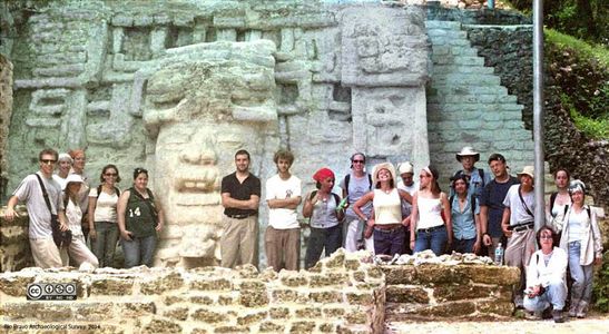
BELIZE
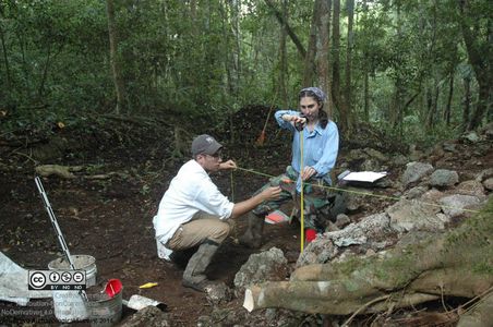
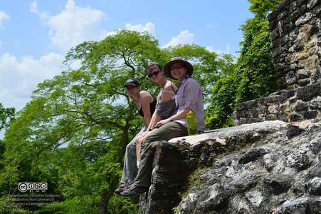
Actuncan Excavation, western Belize
Dates: May 25 to June 22, 2025
Project website: https://ifrglobal.org/program/belize-actuncan/
OVERVIEW
罗
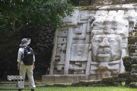
During the Classic Maya period, Actuncan’s political standing changed. By 400 A.D., much of Actuncan’s public architecture was burned, covered in broken pieces of ceramic and abandoned. The remaining occupants of the city were poor farmers, craftspeople, and merchants, not the ruling elites of the site’s earlier glory. Actuncan was no longer a local capital, but a small village under the control of the growing capitals of nearby Buenavista del Cayo and Xunantunich. Though texts are uncommon from this section of the Mopan River valley, Classic Maya hieroglyphic inscriptions from Caracol to the South and sites in modern day Guatemala indicate that the subjugation of Actuncan under its growing neighbors resulted from the competition between the rulers of Caracol and Naranjo for control over the river trade route that passes below Actuncan.
After several centuries, Actuncan reemerged as a local community center during the 8 th and 9 th centuries as Maya rulers faltered across the Maya world as part of the Maya Collapse phenomenon. How did Actuncan yet again rise to power? This is something we think we’re beginning to understand at the Actuncan Archaeological Project. Our research indicates that Actuncan forestalled the impacts of the collapse for a time by abandoning the hierarchy of Classic period Maya divine rulers. Instead, the community gathered and reformed its political institutions around collaborative decision making. Community members built a new council house to anchor this new political form and thrived for a time before the site was totally abandoned.
Since 2001, the Actuncan Archaeological Project has completed 13 research seasons at Actuncan. The project has two major research goals. First, through excavations within households and contexts of public ritual we aim to understand the changing nature of political power across Actuncan’s 2000-year history. We now understand that early in time the site was likely controlled by ruling elites living in the site’s three large urban houses who may have claimed to be kings and queens. At the end of the site’s history, political power was likely located in council-based decisions. In the middle, local residents were impoverished as part of a strategy of subjugation by external powers. However, there is much we do not understand about the arrival of divine rulership at Actuncan and the move to participate in broader pan-Maya networks of power beginning with the 300 B.C. urban renewal event.
Second, through archaeological excavation and survey within Actuncan’s urban core, we are interested in investigating the everyday functioning of long occupied urban places. We use excavation coupled with micro-archaeological forensic methods such as soil chemistry, microartifact analysis, and coring to understand the use of open public spaces, such as plazas. We also try to understand the abandonment and reuse of buildings to understand how people lived among the ruined spaces that inevitably were created in Actuncan’s 2000 year history. Finally, we excavate access points and passageways to understand how people moved through the city at different times, and how the control of movement and strategic placement of monuments and infrastructure were used as tools of rulers’ authority. In all, we’re interested in understanding how past people affected the spaces around them and, in turn, how spaces affected past people.
在
In addition to these excavations, we will begin a new pedestrian survey program to identify archaeological settlements in the modern pastures to the east of the Mopan River. Past research has largely focused on the immediate environs of Actuncan’s core. This new survey effort will aim to identify the extent of hinterland settlement across the river from the site. One finding of our initial work has been that the number of households located in Actuncan’s urban core is quite small. The estimated population from this number of households does not seem sufficient to have constructed architecture of the size present at Actuncan. To understand the nature of early power and authority at Actuncan, we plan to begin a wider survey effort to understand where the site’s population was located and eventually follow with excavations to understand the nature of the relationship between these hinterland settlements and the rulers living in Actuncan’s core.
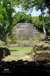
BELIZE
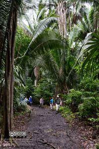
RIO BRAVO ARCHAEOLOGICAL FIELD SCHOOL (Orange Walk District, Belize)
Application website: https://www.belizearchaeologyfieldschool.com/
Approximate Dates for 2025:
(Pre-Season: May 18- June 14, 2025)
Field school: June 15th to July 12th, 2025
Early applications can be completed at https://www.belizearchaeologyfieldschool.com/application
Contact the program at this link for details
Initial application materials can be found here, and a project video here
Session Information
Th
**All students enrolled receive the 200 page Field Manual of the Rio Bravo Archaeological Survey, an annually-updated reference on the field excavation and survey methods used by RBAS.**
Approximate Dates for 2025:
(Pre-Season: May 18- June 14, 2025)
Field school: June 15th to July 12th, 2025
Students who complete a full four-week season are considered Veterans (Junior Staff) and are welcome to stay for the post-season.
Students may wish to travel post-season to Guatemala (the site of Tikal) and/or the Belize Cayes– typically people spend two days at each. For 2025, post-season travel is not included in the schedule or estimated costs. Students wishing to participate in post-season travel need to notify us well beforehand. For liability issues, we cannot allow you to change plans while in-country.
Location: Programme for Belize Conservation and Management Area, Belize, Central America (see Location page)
Costs: The total price for 4-weeks of food and housing is $2300 per student (the amount collected by RBAS). This figure covers food and housing during the field school, transportation to/from the airport (3 hrs each way), field equipment, and daily transportation within the research area. This figure does not include: airfare, inoculations, travel medical insurance, academic credit (if desired), post-season travel, or other personal expenses (e.g., camp “bar” tabs, snacks in town, etc.). See the Approximate Fees section of the 2019 Information Sheet for an estimation of these expenses (n.b. the 2025 Info Sheet will be posted once completed in early 2025).
Students staying beyond four weeks receive slightly pro-rated costs (e.g., $3300 for six-weeks). Please contact the Project Director for more information.
Students at the Community College of Philadelphia (CCP) may inquire about financial aid using the form on the Contact Page. Students from other universities are encouraged to inquire about in-house funding opportunities at their respective institutions. Those who take the course for academic credit are sometimes able to apply federal financial aid to cover their costs as well.
Academic Credit: Taking the field school for academic credit is not required. Credit students and non-credit volunteers receive the same instruction and have the same general field experiences. However, for those students interested, the course is listed for up to 9 credits through the University of Texas at Austin (there is no credit option from the Community College of Philadelphia for 2025). Costs differ for both the amount of credits taken and in-state and out-of-state tuition, so please contact the Project Director if you are interested in participating in the field school for academic credit.
Accommodations: RBAS shares space at the R.E.W. Adams Research Facility in the Programme for Belize Archaeological Project, administered by the University of Texas at Austin. The facility is situated within a protected rainforest, so facilities are relatively rustic. A large wooden dormitory houses most students, but covered tent stations are also used. Be aware that dormitory spaces are 4-person rooms with bunkbeds. Those not in the dormitory will be given a large tent and one tent-mate. Assignment decisions are made upon arrival at camp and are based on the needs of the field station weighted with the preferences of the student. There are several other projects at the camp, so participants are grouped by their project first, but given the limited space, we ask everyone to be flexible with their placement.
Who is Eligible to Apply? Anyone interested in the ancient Maya and archaeological field methods! Students and volunteers of varied ages from across the US have taken part in the field school. The minimum age for applicants is 18. No experience or prerequisite classes are required.
For more detailed information, please download the 2019 Information Sheet (2025 version forthcoming).
Highlights
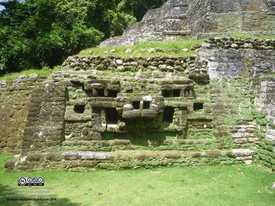
- Discovery and investigation of the forest-covered remains of an ancient Maya community, including a ritual ballcourt
- Mapping and excavating previously unseen, 1200-year-old Maya houses, terraces, reservoirs and other features.
- Carrying out archaeological reconnaissance in unexplored sections of a subtropical forest.
- Taking part in field investigations with students and volunteers from all over the United States.
- Earning optional 3-6 academic credits from UT-Austin or the Community College of Philadelphia.
- Living in a modern archaeological research camp with students and staff from several universities and research projects.
- Visiting restored and forest-covered temples, palaces, ballcourts and other ancient Maya structures at archaeological sites throughout northern Belize.
Project Staff
Stanley L. Walling, PhD., RPA
Project Director- Rio Bravo Archaeological Survey; Associate Director- Programme for Belize Regional Archaeology Project; Research Fellow- Mesoamerican Archaeological Research Laboratory, University of Texas at Austin; Associate Professor of Anthropology- Community College of Philadelphia.
Jonathan A. Hanna, PhD., RPA
Director of Residential Terrace Investigations, Website Coordinator; Previous RBAS Field Seasons: 2003-2007, 2013, 2015-16
Christine Taylor
Director of Ballcourt Investigations; Formerly senior staff on the Maax Na Archaeology Project; Previous RBAS Field Seasons: 2005-2007, 2010, 2012-2019
Chance Coughenour
Director of Mapping; Marie Curie Research Fellow, Institute for Photogrammetry, University of Stuttgart, Germany; PhD. graduate student at University of Seville, Spain; Previous RBAS Field Seasons: 2007, 2010, 2012-2013
JN Stanley
Junior Staff, Previous RBAS field seasons: 2006-2007, 2010, 2012-2013, 2016-19
Carola Garcia Manzano
Junior Staff, Website Assistant; Previous RBAS field seasons: 2007, 2018
Research Collaborators
James Brady– Cave Investigations, University of California at Los Angeles
CL Kieffer– Cave Investigations, PhD. Graduate Student, University of New Mexico
Nicholas Brokaw– Botanical Research, University of San Juan, Puerto Rico
Sheila Ward– Botanical Research, University of San Juan, Puerto Rico
Timothy Beach– Soils and Hydrology Investigations, UT-Austin
Sheryl Luzzader-Beach– Soils and Hydrology Investigations, UT-Austin
RECOMMENDED LINKS:
The Programme for Belize Archaeological Project (PfBAP) is the umbrella project for RBAS, headed by Dr. Fred Valdez at UT- Austin
The Programme for Belize (PfB) is an organization that administers and protects the Rio Bravo Conservation and Management Area (RBCMA)
Academically Speaking contains photos and information from the 2007 RBAS Field Season Mesoweb is a great starting point for information on ancient Mesoamerica
Recommended Books:
Incoming students are required to read at least one of the following overview texts before arriving in Belize:
The Maya by Michael Coe (now 8th edition, Thames and Hudson, New York, 2011)
The Fall of the Ancient Maya: Solving the Mystery of the Maya Collapse by David Webster (Thames & Hudson, New York, 2002)
The Ancient Maya: New Perspectivesby Heather McKillop (W.W. Norton, New York, 2004/2006 paperback)
Highlights From the Three Rivers Region:
Ancient Maya Commoners by Jon Lohse and Fred Valdez (University of Texas Press, Austin, 2004)
Heterarchy, Political economy, and the Ancient Maya: The Three Rivers Region of the East-Xentral Yucatán Peninsula by Vernon Scarborough; Fred Valdez and Nicholas Dunning; (U. Arizona Press, Tucson 2003)
BELIZE
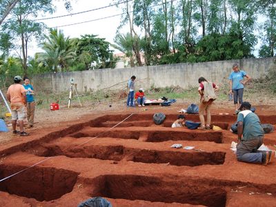
AGUACATE REGIONAL ARCHAEOLOGY PROJECT, BELIZE
Dates: May 13 to June 9, 2024
Program Website:https://fieldsciences.org/program/2024-belize-aguacate/
Application website:https://cfs.embark.com/login/apply?target=2024
Program Syllabus:https://www.fieldsciences.org/wp-content/uploads/2023/12/Syllabus-Belize-Aguacate-2024.pdf
PROGRAM DESCRIPTION
T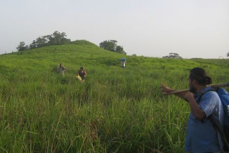 he Aguacate Regional Archaeology Project investigates a series of ancient Maya minor centers and their surrounding settlements. The sites are spread across a series of escarpments at the edge of the Yalbac Hills inwestern Belize. The region features an unusually high density of small, monumental sites, with a wide range of structures from elite residences, temples and ball courts to formal plazuela groups and individual house mounds. Current models of ancient Maya settlement distribution are insufficient to explain the density and extent of Maya populations revealed by recent advances in remote sensing. Particularly striking are examples of extensive house mounds and architectural remains located in regions at a distance from major centers. The suite of sites in the Aguacate region are located at an interstice connecting multiple zones of settlement, present a unique opportunity to understand how Maya polities were connected and how settlements were organized in what were previously considered to be fringe, peripheral areas.
The wide variety of site and feature types in the project area allows us to provide training across the whole range of fundamental archaeological field skills. Students will gain experience in both regional and site survey methods, test excavations, exposure of structures, and the identification, recovery and processing of a wide variety of artifact types. Over the course of the program, students will become familiar with several phases of executing an archaeological field project, from establishing the research question, through data recovery and the initial phases of analysis.
DIRECTORS:
Dr. John Morris, Director Emeritus of the Belize Antiquities Authority and Research Fellow at the University of Pennsylvania (johnmorris8895@gmail.com)
Eric Fries, Archaeologist, National Salvage Implementation Team, Bureau of Land Management (ecfries@gmail.com)
RIO BRAVO ARCHAEOLOGICAL FIELD SCHOOL (Orange Walk District, Belize)
Application website: https://www.belizearchaeologyfieldschool.com/application
Approximate Dates for 2025: TBD, possibly late May to mid-July
Contact the program at this link for details
Initial application materials can be found here, and a project video here
The Rio Bravo Archaeological Survey (RBAS) is a summer Maya archaeology field school that trains students in archaeological field methods within the context of a state-of-the-art research project. The program is situated in an unexplored, tropical rainforest in northern Belize, Central America, and can be taken for 3 or 6 college credits through the University of Texas at Austin.*
Non-credit volunteers are also welcome!
Students who are interested in joining us for the 2023 season should review the information provided, including the 2019 Info Sheet (or forthcoming 2023 sheet), and contact us via email or by submitting an application.
To sign up, please fill out an application.
*RBAS operates in Belize under a permit issued from the Institute of Archaeology to Dr. Fred Valdez, Director of the Programme for Belize Archaeological Project (PfBAP). Academic credit from the Community College of Philadelphia is not available for the 2023 season.
SESSION INFORMATION
Th
**All students enrolled receive the 200 page Field Manual of the Rio Bravo Archaeological Survey, an annually-updated reference on the field excavation and survey methods used by RBAS.**
Students who complete a full four-week season are considered Veterans (Junior Staff) and are welcome to stay for the post-season.
Students may wish to travel post-season to Guatemala (the site of Tikal) and/or the Belize Cayes– typically people spend two days at each. For 2024, post-season travel is not included in the schedule or estimated costs. Students wishing to participate in post-season travel need to notify us well beforehand. For liability issues, we cannot allow you to change plans while in-country.
Location: Programme for Belize Conservation and Management Area, Belize, Central America (see Location page)
Costs: The total price for 4-weeks of food and housing is $2300 per student (the amount collected by RBAS). This figure covers food and housing during the field school, transportation to/from the airport (3 hrs each way), field equipment, and daily transportation within the research area. This figure does not include: airfare, inoculations, travel medical insurance, academic credit (if desired), post-season travel, or other personal expenses (e.g., camp “bar” tabs, snacks in town, etc.). See the Approximate Fees section of the 2019 Information Sheet for an estimation of these expenses (n.b. the 2024 Info Sheet will be posted once completed in early 2024).
Students staying beyond four weeks receive slightly pro-rated costs (e.g., $3300 for six-weeks). Please contact the Project Director for more information.
Students at the Community College of Philadelphia (CCP) may inquire about financial aid using the form on the Contact Page. Students from other universities are encouraged to inquire about in-house funding opportunities at their respective institutions. Those who take the course for academic credit are sometimes able to apply federal financial aid to cover their costs as well.
Academic Credit: Taking the field school for academic credit is not required. Credit students and non-credit volunteers receive the same instruction and have the same general field experiences. However, for those students interested, the course is listed for up to 9 credits through the University of Texas at Austin (there is no credit option from the Community College of Philadelphia for 2024). Costs differ for both the amount of credits taken and in-state and out-of-state tuition, so please contact the Project Director if you are interested in participating in the field school for academic credit.
Accommodations: RBAS shares space at the R.E.W. Adams Research Facility in the Programme for Belize Archaeological Project, administered by the University of Texas at Austin. The facility is situated within a protected rainforest, so facilities are relatively rustic. A large wooden dormitory houses most students, but covered tent stations are also used. Be aware that dormitory spaces are 4-person rooms with bunk-beds. Those not in the dormitory will be given a large tent and one tent-mate. Assignment decisions are made upon arrival at camp and are based on the needs of the field station weighted with the preferences of the student. There are several other projects at the camp, so participants are grouped by their project first, but given the limited space, we ask everyone to be flexible with their placement.
Who is Eligible to Apply? Anyone interested in the ancient Maya and archaeological field methods! Students and volunteers of varied ages from across the US have taken part in the field school. The minimum age for applicants is 18. No experience or prerequisite classes are required.
For more detailed information, please download the 2019 Information Sheet (2024 version forthcoming).
HIGHLIGHTS:
• Discovery and investigation of the forest-covered remains of an ancient Maya community, including a ritual ballcourt
• Mapping and excavating previously unseen, 1200-year-old Maya houses, terraces, reservoirs and other features.
• Carrying out archaeological reconnaissance in unexplored sections of a subtropical forest.
• Taking part in field investigations with students and volunteers from all over the United States.
• Earning optional 3-6 academic credits from UT-Austin or the Community College of Philadelphia.
• Living in a modern archaeological research camp with students and staff from several universities and research projects.
• Visiting restored and forest-covered temples, palaces, ballcourts and other ancient Maya structures at archaeological sites throughout northern Belize.
OVERVIEW
The RBAS and the Field School have focused their energies over several seasons on the investigation of the remains of commoners, the “average” members of Maya Culture, who constituted 95% or more of this ancient civilization. What has emerged from our investigations is a view of Maya commoners as living far more multifaceted lives than was previously believed. Sophisticated placement of structures on the landscape, ingenious manipulation of water across our investigative site, as well as evidence for complex ceremonialism, are giving us insight into the complicated nature of the lives of these “everyday” people. The evidence that is emerging from the site of Chawak But’o’ob (the current focus of investigations in our larger survey zone) are helping us see that the lifestyle of Maya commoners was very likely a complex and highly developed component of Classic Maya Civilization.
COMMONER ARCHAEOLOGY
The RBAS and the Field School have focused their energies over several seasons on the investigation of the remains of commoners, the “average” members of Maya Culture, who constituted 95% or more of this ancient civilization. What has emerged from our investigations is a view of Maya commoners as living far more multifaceted lives than was previously believed. Sophisticated placement of structures on the landscape, ingenious manipulation of water across our investigative site, as well as evidence for complex ceremonialism, are giving us insight into the complicated nature of the lives of these “everyday” people. The evidence that is emerging from the site of Chawak But’o’ob (the current focus of investigations in our larger survey zone) are helping us see that the lifestyle of Maya commoners was very likely a complex and highly developed component of Classic Maya Civilization.
COMMONER CEREMONIALISM
在
The Rio Bravo Archaeological Survey (RBAS) is a summer Maya archaeology field school that trains students in archaeological field methods within the context of a state-of-the-art research project. The program is situated in an unexplored, tropical rainforest in northern Belize, Central America, and can be taken for 3 or 6 college credits through the University of Texas at Austin.*
Non-credit volunteers are also welcome!
Project Director:
Dr. Stanley Walling (swallingccp@gmail.com or swalling@ccp.edu), 1700 Spring Garden Street Philadelphia, PA 19130
Social Sciences Dept., Community College of Philadelphia
Tel. 215-751-8848
PROJECT STAFF
Stanley L. Walling, PhD., RPA
Project Director- Rio Bravo Archaeological Survey; Associate Director- Programme for Belize Regional Archaeology Project; Research Fellow- Mesoamerican Archaeological Research Laboratory, University of Texas at Austin; Associate Professor of Anthropology- Community College of Philadelphia.
Jonathan A. Hanna, PhD., RPA
Director of Residential Terrace Investigations, Website Coordinator; Previous RBAS Field Seasons: 2003-2007, 2013, 2015-16
Christine Taylor
Director of Ballcourt Investigations; Formerly senior staff on the Maax Na Archaeology Project; Previous RBAS Field Seasons: 2005-2007, 2010, 2012-2019
Chance Coughenour
Director of Mapping; Marie Curie Research Fellow, Institute for Photogrammetry, University of Stuttgart, Germany; PhD. graduate student at University of Seville, Spain; Previous RBAS Field Seasons: 2007, 2010, 2012-2013
JN Stanley
Junior Staff, Previous RBAS field seasons: 2006-2007, 2010, 2012-2013, 2016-19
Carola Garcia Manzano
Junior Staff, Website Assistant; Previous RBAS field seasons: 2007, 2018
RESEARCH COLLABORATORS
James Brady– Cave Investigations, University of California at Los Angeles
CL Kieffer– Cave Investigations, PhD. Graduate Student, University of New Mexico
Nicholas Brokaw– Botanical Research, University of San Juan, Puerto Rico
Sheila Ward– Botanical Research, University of San Juan, Puerto Rico
Timothy Beach– Soils and Hydrology Investigations, UT-Austin
Sheryl Luzzader-Beach– Soils and Hydrology Investigations, UT-Austin
RECOMMENDED LINKS:
The Programme for Belize Archaeological Project (PfBAP)
The umbrella project for RBAS, headed by Dr. Fred Valdez at the University of Texas at Austin
The Programme for Belize (PfB)
Organization that administers and protects the Rio Bravo Conservation and Management Area (RBCMA)

BOSNIA AND HERZEGOVINA
DISEASE CONFINEMENT IN THE ADRIATIC: BOSNIA AND HERZEGOVINA (Stanford University Archaeology Center)
Project website: https://archaeology.stanford.edu/academics/field-experience/disease-confinement-adriatic-bosnia-and-herzegovina
Dates: June 16 to July 12, 2025
Undergraduate Field Experience
This field experience is led by Archaeology Center faculty member Krish Seetah. The summer fieldwork season will be held within close reach of medieval economic superpowers – Dubrovnik & Venice – that controlled the Adriatic Sea. The fieldwork will be undertaken at two sites, Milavići cemetery, and Baljci, a multiperiod burial ground adjacent to a UNESCO-protected medieval stećci burial ground, both with bioarchaeological evidence of disease, located on a former transportation route for slaves from central Bosnia to the coast.
In-Person: In the field, you will learn fundamental archaeological field research skills, such as tool and equipment handling, principles of archaeological excavation, proper recording of the layers and finds (in paper, photographic, and digital form), and artifact management (cataloging, storing and preparation for analyses). The full extent of the excavations will incorporate the concepts and principles of landscape archaeology, using numerous well-established protocols: landscape digital technologies (geophysics, a series of GIS analyses, UAV rendered maps, 3D models of the tombstones), training in epigraphy, geomorphology, in human and animal osteology and the varieties of sampling for further micro-archaeological analyses.
Remote: The non-contact contingency plan for this project will involve students supporting our work to digitize a large and unique repository of burial archives. Students would help to transcribe this historical dataset – containing evidence of the cause of death, age, place of death, etc., – into a searchable database. This would allow us to correlate ecological conditions and demography with transmission profiles over ~100 years, which could then also form the basis for standalone student projects.
In addition, students will support our team to produce 3-D models of the cemetery locations themselves, which are a rich cultural heritage. This will be based on existing digital imagery and drone aerial footage, which will then be used for virtual reality expositions (we have a VR expert as part of our team). Students may also work on several smaller sub-projects, including digitization of excavation documents, modeling of artifacts and human remains from within the graves themselves, and large-scale GIS mapping of our sites.
What Will You Do
- Archaeological Record-Keeping
- Disease Modeling
- Archaeological Excavation
- Cultural Exchange
Requirements for Participation
- Students accepted to our field experiences are required to participate in pre-departure meetings with the faculty leader of their program in the quarter prior to departure. Each field experience has different pre-departure requirements that will be communicated by the faculty leader.
- Upon their return to Stanford, the Archaeology Center requires that all field experience students participate in SURPS (Symposia for Undergraduate Research and Public Service). Students from each field experience are expected to work together to complete an application, prepare a poster, and present at the SURPS event on the Friday of the reunion homecoming weekend.
- Each of our field experiences is part of an ongoing research project led by a Stanford faculty member. While in the field, undergraduates are expected to contribute to the team effort of the archaeological project at the faculty member’s direction. Fieldwork can take the form of a number of different activities, from clearing undergrowth in preparation for excavation to laboratory analysis of archaeological samples. Each day’s activities can look different, and may change depending on the evolving direction of the research. Students participating in a field experience should be prepared to be flexible and responsive to the instructions of the faculty member or other senior project staff.
Application Information
- This field experience opportunity is open to all undergraduates except graduating seniors.
- Undergraduates from all majors are encouraged to apply.
- No prior knowledge of archaeology is required, although we prefer to support students who will pursue an archaeology-centered career. All necessary training will be provided while in the field.
- Applicants will need an updated passport by the time of acceptance
- Acceptance to the Bosnia and Herzegovina field experience comes with funding for eligible expenses subject to the budget of the project. Housing, daily meals, and materials used on-site will be fully covered by the project. The Archaeology Center will issue a stipend to students to purchase flights based on the real costs of flights to and from their field site. Students will be informed of the stipend limit prior to booking. Per university policy, the Archaeology Center does not pay for personal travel outside the dates or locations of field experiences.
- If the Bosnia and Herzegovina archaeology field experience is run remotely, accepted students will receive stipends from VPUE. Stipend amounts will be determined by VPUE and communicated to students when they are accepted to the field experience.
- Students who plan to participate in an archaeology field experience cannot receive a major grant or a Chappell-Lougee scholarship within the same academic year as their field experience.
Learn more about generalfield experience opportunitieswith the Stanford Archaeology Center.
BULGARIA
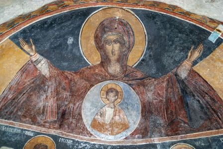
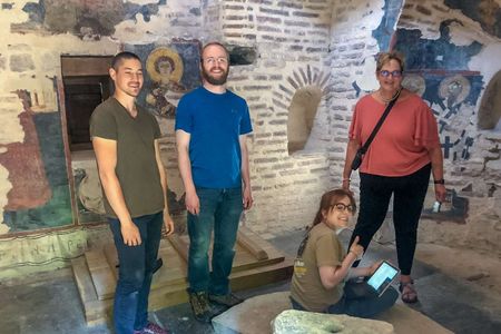
”Fresco-Hunting” Photo Research Expedition to Medieval Balkan Churches
BULGARIA
2025 Bulgaria Apollonia/Messarite: Hellenistic & Roman Period Excavations
Project website: https://www.fieldsciences.org/program/2025-bulgaria-apollonia/
Project Dates: June 1-28, 2025 Tuition payment deadline: April 4, 2025
2025 course syllabus can be viewed at https://www.fieldsciences.org/wp-content/uploads/2024/12/Syllabus-Bulgaria-Apollonia-2025.pdf
OVERVIEW
Ancient Apollonia Pontica (present-day Sozopol, Bulgaria) is one of the oldest towns on the western Black Sea Coast. The city, founded by Miletian colonists around 610 BCE, was named Apollonia Pontica in honor of the patron deity of Miletus – Apollo. Apollonia became an autonomous and strong independent polis, as well as an important trade center between Ancient Greece and Thrace. Thanks to its strong navy and naturally protected harbors, Apollonia kept control of the major maritime and terrestrial merchant routes along the western Black Sea Coast for several centuries. Despite numerous invasions and attacks, the city survived the period of the Great Migration (4th – 7th century CE) and entered the Middle Ages as a focal point of long-lasting Byzantine-Bulgarian conflicts.
The project is focused on the sector of Messarite, located southwest of Sozopol, approx. 2 km from the center of the Old Town. During the initial survey of the area, 29 different features were identified, including walls, buildings and burials. Excavations at the Messarite sector will help in understanding the interaction between city center and its immediate outposts. It will shed light on the economic development of Apollonia Pontica in the Late Classical and Hellenistic periods.
INTRODUCTION
一个
The project is focused on the sector of Messarite, located southwest of Sozopol, approx. 2 km from the center of the Old Town. During the initial survey of the area, 29 different features were identified, including walls, buildings and burials. A Franco Bulgarian team excavated the area in 2002-04 and explored six buildings dated between the second half of the 5th century BCE and the beginning of the 3rd century BCE. The team also found parts of an ancient road oriented north-south were also discovered.
Towards the end of the 4th century BCE, the buildings at the Messarite sector were abandoned and destroyed. Shortly thereafter, burials with both inhumations and cremations began appearing in the abandoned ruins. In one area, family plots enclosed with stone walls (periboloi) were identified. The burial structures vary from pits, pithoi, ceramic and limestone sarcophagi, to tile-lined and cist graves while the cremations are in locally made urns. The family plots had indications of traditional funerary rites, including 10 ritual firepits.
These are unique excavations of the broader territory of an ancient Greco-Roman colony in present-day Bulgaria. The results from the excavations along with the traces of mining and metallurgy in the adjacent area will shed light on the economic development of Apollonia Pontica in the Hellenistic and Roman periods.
COURSE OBJECTIVES
At the end of the field school, participants will:
- Dig at an Ancient Greco-Roman site on the Black Sea Coast.
- Understand archaeological methods for studying Classical period material culture
- Practice all basic excavation and recording techniques in the field
- Develop skills in artifact retrieval and processing with a focus on Classical material culture
- Expand knowledge oof the Classical world and the use of interdisciplinary approaches (geology, biology, physics) for its research
- Visit significant archaeological and historic sites: Nessebar, ancient Mesambria (UNESCO World Heritage Site), ancient Deultum near Burgas and Sozopol, ancient Apollonia Pontica.
DIRECTORS: Dr Angela Pencheva, PhD in Archaeology, Program Director of the Balkan Heritage Foundation (bhfs.admissions@gmail.com)
Dr. Krastina Panayotova, Associate Professor and Head of the Department of Classical Archaeology, National Archaeological Institute with Museum, Bulgarian Academy of Sciences (bhfs.admissions@gmail.com)
Dr. Teodora Bogdanova, Department of Classical Archaeology, National Archaeological Institute with Museum, Bulgarian Academy of Sciences, Adjunct Professor, CPCE, New Bulgarian University, Bulgaria (bhfs.admissions@gmail.com)
BULGARIA
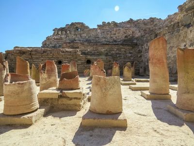
Conservation of Ancient Greek Pottery (Debelt, Bulgaria)
Dates: June 7 to June 21, 2025 Application deadline: June 7, 2025
Project website: https://www.fieldsciences.org/program/2025-bulgaria-debelt-greek-pottery/
Project syllabus: https://www.fieldsciences.org/wp-content/uploads/2024/12/Syllabus-Bulgaria-Debelt-Pottery-2025.pdf
INTRODUCTION
This field school is an introductory workshop for the conservation of ceramics, using ancient Greek pottery recovered from sites in the Western Black Sea coast of Bulgaria. This program guide students through the history of Ancient Greek pottery and the process of pottery conservation, restoration, documentation, and study. Both the theoretical and laboratory elements of this program will be taught at the research center associated with the Roman site of Deultum (see more about the site below).
The course includes three modules: 1) practical work in conservation of ancient pottery, working on ceramic artifacts recovered during excavations at cemetery of Apollonia Pontica (present-day Sozopol, Bulgaria); 2) lectures on topics related to the archaeological context of conserved vessels and to conservation process of ancient Greek pottery; 3) excursions to the ancient coastal towns of Nessebar (UNESCO World Heritage Site) and a tour of Sozopol (including study visits to their archaeological museums).
Develton (Thracian: Debelton, “two-swamp area”) was founded as an emporium of Apollonia Pontica in the 7th century BCE. From the 6th century to the 4th century BC, the settlement served as an important place of trade between Thracians and Greeks. Develton was annexed to the Roman Empire in 46 CE and became part of the province of Thrace and its name changed to Deultum. At the Battle of Deultum in the summer of 377 CE (during the Gothic War of 376–382), an Eastern Roman army was defeated by a Gothic raiding party outside Deultum, and the city was sacked. Deultum was later rebuilt on a smaller scale, and, in the second half of the 5th century CE, new walls were constructed, and all unprotected buildings were demolished to ensure hostile forces did not use them as cover. These walls were destroyed by Slavs and Avars at the end of the 6th century CE.
COURSE OBJECTIVES
By the end of the program the participants will:
- Be introduced to basic methods of conservation and documentation of ancient pottery.
- Be able to develop basic/further practical skills (depending on participant’s initial level of qualification) in ancient pottery conservation and illustration.
- Deepen their knowledge through first-hand experience with ancient Mediterranean/European History and Archaeology.
- Meet professionals who work in the areas of Classical Archaeology and Pottery Conservation and Documentation.
DIRECTORS: Dr. Daniela Cherneva, Chief instructor, Balkan Heritage Foundation Affiliate Conservator (daniela.cherneva@gmail.com)
Ms. Biljana J. Peeva, Restorer of Pottery and glass Artefacts at the National Institution Stoby (biljanapeeva@gmail.com)
Dr. Teodora Bogdanova, Assistant Professor in Archaeological Institute with Museum at the Bulgarian Academy of Sciences & Adjunct Professor, CPCE, New Bulgarian University (vorbog@gmail.com)
Dr. Margarit Damyanov, Assistant professor at the Department of Thracian Archaeology, Archaeological Institute with Museum at the Bulgarian Academy of Sciences (mmdamyanov@gmail.com)
Mr. Alexander Manev, PhD Candidate, Department in Classical Archaeology, Archaeological Institute with Museum at the Bulgarian Academy of Sciences (dodgealeman@gmail.com)
BULGARIA
Conservation of Ancient Roman Glass (Debelt, Bulgaria)
Dates: June 22 to July 5, 2025
Project website: https://www.fieldsciences.org/program/2025-bulgaria-debelt-roman-glass/
Project syllabus: https://www.fieldsciences.org/wp-content/uploads/2024/12/Syllabus-Bulgaria-Debelt-Roman-Glass-2025.pdf
INTRODUCTION
This program is focused on the conservation of Roman glass. The program will begin by understanding the rich history of ancient glass, its origin and the technology needed for its production. The program will then proceed to instruct students in modern techniques of glass conservation, restoration, documentation and study. Both the theoretical and laboratory elements of this program will be taught at the research center associated with the Roman site of Deultum (see more about the site below).
This field school includes three modules. The first is practical work in conservation of glass, initially of replicas and then work on Roman artifacts from the collection of the National Archaeological Reserve at Deultum. The second module covers the theoretical and methodological elements of glass conservation and consists of lectures presenting the archaeological context of glass artifacts and the best methods used for their preservation. conserved vessels and to conservation process of glass vessels. The third module introduces students to the regional context of Roman presence and includes site visits to the ancient coastal towns of Nessebar (UNESCO World Heritage Site), and a sightseeing tour of Sozopol (including study visits to its archaeological museums). An optional two day excursion to Istanbul (Turkey) is possible and interested students should contact Balkan Heritage Foundation directly for details (email bhfs.admissions@gmail.com)
Develton (Thracian: Debelton, “two-swamp area”) was founded as an emporium of Apollonia Pontica in the 7th century BCE. From the 6th century to the 4th century BC, the settlement served as an important place of trade between Thracians and Greeks. Develton was annexed to the Roman Empire in 46 CE and became part of the province of Thrace and its name changed to Deultum. At the Battle of Deultum in the summer of 377 CE (during the Gothic War of 376–382), an Eastern Roman army was defeated by a Gothic raiding party outside Deultum, and the city was sacked. Deultum was later rebuilt on a smaller scale, and, in the second half of the 5th century CE, new walls were constructed, and all unprotected buildings were demolished to ensure hostile forces did not use them as cover. These walls were destroyed by Slavs and Avars at the end of the 6th century CE.
COURSE OBJECTIVES:
By the end of the program the participants will: ➢ Be introduced to the basic methods for conservation and documentation of ancient glass. ➢ Be able to develop basic skills in ancient glass conservation and documentation. ➢ Have first-hand experience with ancient Mediterranean/European History and Archaeology. ➢ Meet professionals, who work in the areas of Classical Archaeology and Glass Conservation and Documentation. ➢ Contribute to the preservation of research of archaeological collection of the National Archaeological Reserve Deultum.
DIRECTORS: Dr. Daniela Cherneva, Chief instructor, Balkan Heritage Foundation Affiliate Conservator (daniela.cherneva@gmail.com)
Ms. Biljana J. Peeva, Restorer of Pottery and glass Artefacts at the National Institution Stoby (biljanapeeva@gmail.com)
BULGARIA
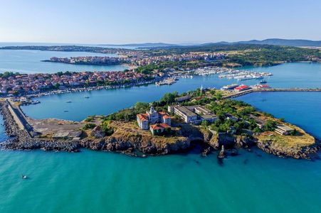
Archaeology of Apollonia Pontica (Sozopol, on Bulgarian Black Sea coast)
Dates: June 1-28, 2025 Application deadline: until filled, or April 10, 2025
Project website: https://www.bhfieldschool.org/program/ancient-greek-excavtions-apollonia-pontica
General Information
Project type: This field school features archaeological excavation at a Classical and Late Hellenistic site. The variety of activities and the team’s professionalism and flexibility make this project suitable for beginners and advanced students in both Anthropology and Classical Archaeology. Individual program and task assignments are available to advanced students.
Field school start date: 2011 – 2019 on St. Kirik island; 2023 start of field school at Messarite
Site: Messarite – located 2 km southwest of Apollonia Pontica (today’s Sozopol on the Bulgarian Black Sea coast) – is part of the ancient city’s broader area where the remains of an ancient road, foundations of buildings and burial structures are located.
Period(s) of occupation: Classical Greek, Hellenistic (5th – 3rd century BCE)
Project venue: Hotel Polina Beach is located in the new part of Sozopol, a 15-minute walk from the town center and the larger beach “Harmanite.” It offers rooms with sea views, a restaurant and a pool. It is also a 15-minute walk from the venue to the excavation site. The first part of the field school will be conducted at the “Archaeological Reserve with Museum – Deutum” in Debelt (approx. 20 km from Burgas) where the facilities provide suitable conditions for lab work.
The project partners: Balkan Heritage Foundation (BHF), Bulgaria, Apollonia Pontica Excavation Team from National Archaeological Institute with Museum, Archaeological Museum of Sozopol, University of Idaho (US), New Bulgarian University
Dig director: Krastina Panayotova, PhD in Archaeology, Associate Professor and Head of the Department of Classical Archaeology, National Archaeological Institute with Museum, Bulgarian Academy of Sciences
Deputy dig director and chief instructor: Teodora Bogdanova, Ph.D. in Archaeology, Department of Classical Archaeology, National Archaeological Institute with Museum, Bulgarian Academy of Sciences, Adjunct Professor, CPCE, New Bulgarian University, Bulgaria
Field school coordinators: Angela Pencheva, PhD in Archaeology, Program Director of the Balkan Heritage Foundation, Lyuba Manoilova, PhD candidate in Anthropology at the Institute of Experimental Morphology, Pathology and Anthropology with Museum Bulgarian Academy of Sciences; project coordinator at the Balkan Heritage Foundation
Major field school topics/activities: Ancient Greek colonization, culture, and religion; archaeological field techniques and methods; finds and sample processing; trips to significant heritage sites along the western Black Sea Coast.
Number of field school places available: Maximum 20
Project language: English
Academic credits available: Students can receive up to 9 ECTS credits through New Bulgarian University, Bulgaria.
Special requirements: The project is not recommended for individuals with solar allergies or other special illnesses that might be exacerbated during intensive outdoor activities. The average summer temperatures in the area are 25-35° C (77- 95° F) or higher.
The Site and the Excavation Project
一个
The site “Messarite” is located southwest of Sozopol, approx. 2 km from the center of the Old Town. During archaeological field surveys in this area were registered 29 sites – remains of buildings, fortification walls for artificial terraces of the land and three tombs. The site is divided into three sectors on the western slope on the eastern side of a small valley where the small chapel “St. Marina” is located. Dr. Panayotova’s team excavated the remains of six buildings dated between the second half of the 5th century BCE and the beginning of the 3rd century BCE. Parts of an ancient road oriented north-south were also discovered. It is 6,50 m wide and so far over 40 m of its length were uncovered. On both sides, there are remains of buildings.
Towards the end of the 4th century BCE, the buildings in all three sectors were abandoned and destroyed. Shortly after graves with both inhumations and cremations started appearing in the abandoned ruins. In one area there are even family plots enclosed with stone walls (periboloi). Until now a total of 42 graves have been excavated all dated in the first half of the 3rd century BCE. The burial structures vary from pits, pithoi, ceramic and limestone sarcophagi, to tile-lined and cist graves while the cremations are in locally made urns. The funeral gifts are typical for the period – incense vessels (lekithoi and unguentaria), funeral wreaths, strigili, mirrors, scissors, coins and jewelry. In front of the family plots were discovered traces of funerary rites including 10 ritual firepits.
These are the first excavations of the broader territory of an ancient Greek colony in present-day Bulgaria. The results from the excavations along with the traces of mining and metallurgy in the adjacent area shed light on the economic development of Apollonia Pontica in the Classical and Hellenistic periods.
The Field School
This field school provides a unique glimpse into the early stages of the Greek Colonization of the western Black Sea Coast and the development of a small Greek settlement into one of the richest and strongest Greek colonies in the Black Sea region, as well as an amazing opportunity to:
- dig at an Ancient Greek site on the Black Sea Coast;
- practice all basic excavation techniques in the field plus finds and samples processing;
- visit significant archaeological and historic sites in Bulgaria such as Nessebar, ancient Mesambria (UNESCO World Heritage Site), ancient Deultum near Burgas and Sozopol, ancient Apollonia Pontica, etc.
The Field School Season in 2025 envisions excavations at Messarite in a new sector opened next to the previously conserved area.
The field school offers one four-week session. It includes fieldwork, lectures and instructions in Classical field archaeology, workshops for finds processing and documentation, as well as study visits to significant archaeological and historical sites.

The Site and the Excavation Project
 Ancient Apollonia Pontica (present-day Sozopol, Bulgaria) is one of the oldest towns on the w
The site “Messarite” is located southwest of Sozopol, approx. 2 km from the center of the Old Town. During archaeological field surveys in this area were registered 29 sites – remains of buildings, fortification walls for artificial terraces of the land and three tombs. The site is divided into three sectors on the western slope on the eastern side of a small valley where the small chapel “St. Marina” is located. Dr. Panayotova’s team excavated the remains of six buildings dated between the second half of the 5th century BCE and the beginning of the 3rd century BCE. Parts of an ancient road oriented north-south were also discovered. It is 6,50 m wide and so far over 40 m of its length were uncovered. On both sides, there are remains of buildings.
Towards the end of the 4th century BCE, the buildings in all three sectors were abandoned and destroyed. Shortly after graves with both inhumations and cremations started appearing in the abandoned ruins. In one area there are even family plots enclosed with stone walls (periboloi). Until now a total of 42 graves have been excavated all dated in the first half of the 3rd century BCE. The burial structures vary from pits, pithoi, ceramic and limestone sarcophagi, to tile-lined and cist graves while the cremations are in locally made urns. The funeral gifts are typical for the period – incense vessels (lekithoi and unguentaria), funeral wreaths, strigili, mirrors, scissors, coins and jewelry. In front of the family plots were discovered traces of funerary rites including 10 ritual firepits.
These are the first excavations of the broader territory of an ancient Greek colony in present-day Bulgaria. The results from the excavations along with the traces of mining and metallurgy in the adjacent area shed light on the economic development of Apollonia Pontica in the Classical and Hellenistic periods.
BULGARIA
Excavation of Emporion Pistiros, Thrace (Septemvri, Bulgaria)
Dates: July 25 to Aug 22, 2025 Application deadline: Feb. 1, 2025
Project website: https://www.bhfieldschool.org/program/ancient-greek-excavations-pistiros
General Information
Project type: field school & archaeological excavations. The course is a balanced combination of lectures in the field of Classical Archaeology, with a focus on Thrace and fieldwork on the site of the Greek emporion Pistiros.
The course is designed primarily for students in Classical Archaeology, Anthropology, History, Art History, and other related scientific fields but the variety of activities and the team’s professionalism and flexibility make this project suitable for both beginners and advanced students in Classical Archaeology.
Site is between the small towns of Septemvri and Vetren, Southern Bulgaria.
Project venue: Villa Velis is a tourist complex including a SPA hotel and a winery. It is located in the southern part of the village of Karabunar, 8 km from the motorway exit “Trakia” on the road to Velingrad. During the project work days all participants will be provided with transportation from the hotel to the site (that is located 14 km away) and back.
Period(s) of occupation: Late Classical, Hellenistic (5th – 3rd century BCE)
Major field school topics/activities: Archaeological field techniques and methods for excavation and documentation; Ancient Greek and Thracian archaeology in the light of their trade and religious interaction at the site; RTI (Reflectance Transformation Imaging) documentation of Late Classical and Hellenistic finds, excursions to significant heritage sites in Thrace, Bulgaria.
BHF partners in this project: Septemvri Archaeological Museum “Prof. Mieczyslaw Domaradzki”, Pistiros Excavation Team from the National Archaeological Institute with Museum, Bulgarian Academy of Sciences, Pazardzhik Regional Museum of History, “Pistiros” Association and New Bulgarian University (Bulgaria).
FIELD SCHOOL DIRECTOR(S) Dr. Angela Pencheva, Visiting professor at the Department of Archaeology and Center for Vocational and Continuing Education, New Bulgarian University, Sofia; Balkan Heritage Program Director (angelapbh@gmail.com)
Dig Directors: Ass. Prof. Dr. Alexey Gotsev, National Archaeological Institute with Museum, Bulgarian Academy of Sciences Ass. Prof. Dr. Emil Nankov, National Archaeological Institute with Museum, Bulgarian Academy of Sciences
Field school sessions available:
- Field school four-week session: 26 July- 22 August, 2025
Application deadlines: until the places are filled or 21 June, 2025
Minimum length of stay for participants: four weeks
Minimum age: 18 (16, if the participant is accompanied by an adult family member)
Number of field school places available: Maximum 20
Project language: English
Academic credits available: 9 ECTS credits are available through New Bulgarian University, Bulgaria.
Experience required: No previous experience is required.
Special requirements: Participation in the project is not recommended for individuals with solar allergies or other special illnesses that might be exacerbated during intensive outdoor activities. The average summer temperatures in the area are 25-38° C (77 – 100° F) or higher. All participants should bring clothes and toiletries suitable for hot and sunny weather but should also prepare for possible rainy, windy and chilly days. Participants are also expected to prepare for the dig by reading at least the BHFS handbook that will be sent by e-mail before the beginning of the project. Participants will use the tools and equipment available at the site and are not expected to bring any additional equipment.
The participants should have medical insurance including repatriation. The participants should inform the project staff about any health issues, allergies, and food preferences.
The Site and the Excavation Project
The ruins of an Ancient Greek trade center (emporion) in the heart of Thrace – on the left bank of Maritsa River (ancient Hebros), between the towns of Vetren and Septemvri, were discovered by Prof. M. Domaradzki in 1988. He started regular excavations and in 1990, his team found a stone inscription (known as “Vetren inscription”) that helped the scholars identify the site as the Ancient Greek emporion named Pistiros. Merchants from Greek coastal cities of Maroneia, Thassos and Apollonia lived and traded there with their Thracian neighbors under the supreme protection of the Thracian Odrysian kings (the biggest and mightiest Thracian Kingdom at that time). Up to the moment Pistiros is the only certainly identified emporion in the heart of Thrace. That is why excavation of the site are significant source of information for the political, economic and cultural history of the Odrysian kingdom and Thrace in this period.
The emporion was also a major metallurgical center and a key harbor for export of metals and metal products from Thrace to Greece in the Classical and Early Hellenistic periods (from the middle of the 5th to the beginning of the 3rd century BCE). The trade contacts of the emporion are evident through finds of numerous imports such as Attic red-figured and black-slip pottery, amphorae (mainly Thassian) and coins (e.g. several hoards of copper, silver and gold coins found during the excavations – they represent the coinage of different Odrysian kings (e.g. Amatokos I, Bergaios, Kotys I, Amatokos II, Teres II, Kersebleptes, Teres II), Greek cities (Thassos, Maroneia, Parion, Thracian Chersonese, Enos, Apollonia, Messabria etc.) and Macedonian rulers (Philip II, Alexander the Great, Kassandros, Demetrios Poliokretes, Lysimachos etc.).
Most of the ancient authors and the majority of the modern scholars consider the cult of Dionysos rooted in Thrace. Apparently, it played a very important role in the emporion’s religious life. For instance, the Vetren inscription informs about the oath taken in the name of Dionysos by the Odrysian king: Kotys I (383-359 BCE) and his successor from the citizens of Pistiros – this is how they guaranteed the integrity of their lives, properties and activities in their town under the sovereignty of the Thracian kings.
Pistiros history in brief:
- around 500 BCE – Date of the earliest artifacts found on the territory of Pistiros.
- 475 – 450 BCE – Date of the earliest Attic pottery found at the site – the foundation of Pistiros (like the foundation of the most Greek apoikias elsewhere) was probably preceded by various previous colonial economic and political activities. Greek economic and cultural penetration in the interior of Thrace was intensified after the Persian withdrawal from the Balkans following the battles of Marathon (490 BCE) and Salamis (480 BCE);
- 450 – 425 BCE – Foundation of the emporion by colonists from the Aegean cities of Maronia, Thassos and Apollonia. Major structures and features of fortification and drainage system were constructed along with tracing and paving of the streets;
- 370s BCE – Period of significant reconstructions in the emporion during the reign of the Thracian Odrysian king Kotys I;
- 359 – 357 BCE – Citizens of Pistiros re-contracted their rights and obligations with the successor of Kotys I;
- 350/345 BCE – The emporion suffered from the invasion of Philip II Macedon in Thrace;
- 300 BCE – Devastation of Pistiros by the Celts;
- 278 BCE – Massive invasion of the Celts in the Balkans: Ultimate devastation of the emporion. Afterwards the settlement lost its trading importance and turned into a metal production centre with local importance.
So far, archaeologists have uncovered the eastern fortification wall of the emporion (having one gate, a tower, and a bastion – all built of stone blocks analogically to the Thassian fortification system), streets paved by stone plates, solid stone foundations of two buildings as well as an efficient drainage system. Buildings of different types are indicating at least two different chronological horizons of the site’s existence. The investigation of their characteristic features and shapes, as well as the emporion’s planning are among the major research questions concerning Pistiros, together with the following others:
- what is the dynamic of architectural evolution of the settlement following the disasters such as devastation, earthquakes, fires and floods;
- which ancient cults were practiced in Pistiros;
- what were the relations and the interactions between the different ethnic groups in Pistiros: Greeks, Thracians, Celts.
The Field School
黑洞
The participants in 2025 in Ancient Greeks in the Land of Dionysos – Excavation of Emporion Pistiros will be included in the further excavation of the same sectors.
The field school in 2025 includes the following three modules:
- Fieldwork including excavation, maintaining a field journal on a daily basis, filling context sheets and labels, drawing an elevation plan / a ground plan/ a cross-section, 3D positioning of finds, taking coordinates with a level device, and taking photographs at the site;
- Lectures, workshops and field training in Classical and Field Archaeology, finds processing and documentation;
- Excursions to various cultural and archaeological sites in the region such as the ancient town of Philippopolis, present day Plovdiv (Please refer to the Course Program on the project website).
BULGARIA
TELL YUNATSITE EXCAVATIONS – EARLY NEOLITHIC AT THE BALKAN PENINSULA
Project website: https://www.fieldsciences.org/program/2025-bulgaria-yunatsite/
Project Dates: July 12 to August 9, 2025
Project website: https://www.fieldsciences.org/program/2025-bulgaria-yunatsite/
Project syllabus: https://www.fieldsciences.org/wp-content/uploads/2024/12/Syllabus-Bulgaria-Yunatsite-2025.pdf
INTRODUCTION
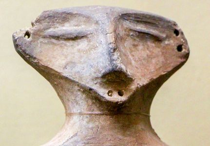 During the 7th-6th millennia BCE, farming and animal husbandry spread from Anatolia and the Near East through the Balkan Peninsula and to Europe. These were not new technologies adopted by local populations but newcomers who brought a completely new way of life and subsistence, initially coexisting and then taking over local populations. By the 6th millennium BCE, the local economy, social organization, trade, and cultural contacts evolved, to reach its peak in the 5th millennium BCE. Even newer technologies came to bear, when locals begin processing – and using –metals such as copper and gold.
Recent excavations at Tell Yunatsite indicate that the Chalcolithic/Final Neolithic period settlement at the site covered an area far larger than the tell itself. The site had an uptown (acropolis?) sector and a downtown district. The uptown sector was surrounded by a five meter wide clay wall and a broad and deep ditch. Buildings in this part were placed close to each other, creating an almost unbroken urban fabric that is easy to close and defend.
Despite their defensive resource investment, the Chalcolithic/Final Neolithic settlement at Yunatsite experienced a violent event at ca. 4,200-4,100 BCE. Evidence suggests deliberate destruction by outsiders. Skeletons of children, elderly men, and women were found scattered on floors, suggesting a massive massacre. Those who survived returned and resettled at the tell, but soon even they left. At that point, Tell Yunatsite and the area around it were abandoned for more than 1,000 years. During this time, a sterile layer accumulated over the last Chalcolithic/Final Neolithic layer.
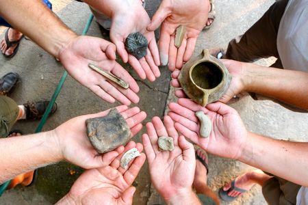 To date, approximately one third of the tell has been excavated. This work yielded rich collections of archaeological materials, and the sterile soil has not yet been reached. There is a medieval cemetery at the top of the tell, followed by a Roman period level, two Iron Age levels, another dated to the Early Bronze Age, and finally a Chalcolithic/Final Neolithic level. It is unknown if the cultural history of the tell begins in the Chalcolithic/Final Neolithic period or whether older Neolithic occupation layers exist.
The archaeological field school takes place at the Tell Yunatsite lowest excavated layer, which corresponds to the time of Europe’s first prehistoric civilization in the 5th millennium BCE.
COURSE OBJECTIVES
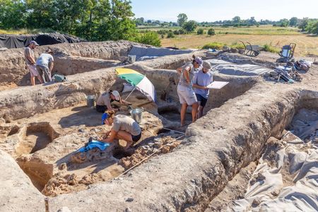 The aim of the project is to provide participants with a theoretical background on the development of Neolithic cultures in Southeastern Europe with a focus on Final Neolithic/Chalcolithic, Europe’s first civilization, and with practical experience in excavating a complex prehistoric tell-site.
This field school provides a unique glimpse into the rise and fall of arguably the earliest European civilization. In 2024, field school students will take part in further excavation of the burned Final Neolithic/Chalcolithic layer buildings. Faculty and students will work together and explore why and how did one of the earliest proto urban centers in Europe emerged in the beginning of the 5th millennium BCE, and what are the reasons that caused its collapse 800 years later.
This field school covers the following three modules:
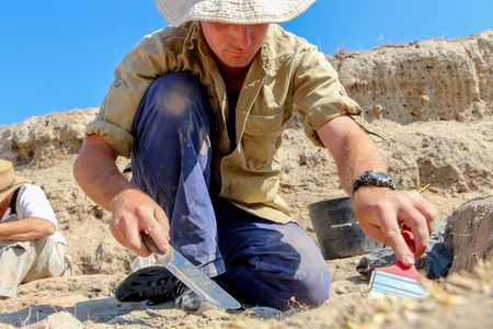
- Fieldwork includes the excavation of the Final Neolithic/Chalcolithic layers and structures, which includes practicing basic excavation techniques as well as screening, sifting and flotation; the development of archaeological field documentation by maintaining a daily field journal, filling context sheets and labels, drawing an elevation plan/ a ground plan/ a cross-section, 3D positioning of finds, taking coordinates with a dumpy level, as well as taking photographs at the site.
- Lectures, workshops, and field training in prehistoric (with emphasis on Neolithic, Chalcolithic, prehistoric warfare, and ceramics), and field archaeology, find processing and documentation.
- Excursions to the Pazardzhik Regional Museum of History; the ancient town of Plovdiv including the Archaeological Museum, Old Town Quarter, and major Roman monuments; and Stara Zagora including the Regional Museum of History, Roman monuments, and the Museum of Europe’s best-preserved Neolithic (5,600 BCE) dwellings.
DIRECTOR: Prof. Kamen Boyadzhiev, National Archaeological Institute with Museum, Bulgarian Academy of Sciences (kamenyb@abv.bg)
BULGARIA
NESSEBAR UNDERWATER ARCHAEOLOGY IN THE BLACK SEA (Nessabar, Bulgaria)
Project website: https://ifrglobal.org/program/bulgaria-underwater-archaeology/ or https://www.bhfieldschool.org/program/underwater-archaeology-in-the-black-sea
Dates: May 24 to June 14, 2025. Application deadline April 25, 2025
Prerequisites
This program requires participants to have Open Water Diver Certification (any world-wide recognized training organization) and DAN diving insurance (http://www.daneurope.org/insurance) and to complete a Medical Approval Form prior to the beginning of the field school.
Field school highlights:
- Contribute to our understanding of coastal landscape changes & human adaptation strategies to sea level fluctuations.
- Develop professional skills in underwater archaeology, including reconnaissance surveys, excavations, mapping, photogrammetry, 3D modeling, and more.
- Experience the charm of Nessebar & the beauty of the Bulgarian Black Sea Coast.
OVERVIEW
Th
A key component of the project is raising public awareness of the local archaeological heritage in order to facilitate and gain support for its protection, study and presentation. This component will be achieved through developing a project for the establishment of an underwater museum of archaeology (diving sightseeing tour) and showcasing the submerged heritage and landscapes. Students will help with the development of such program think-tank actions, individual idea proposals (student assignments), communication with local people, diving centers, tourists and local archaeologists.
Nessebar and its Cultural Heritage
佛
In 72 BCE, the town was conquered by Roman armies without resistance. After a temporary occupation in the beginning of the 1 st century CE, it was included permanently within the borders of the Roman Empire. After the capital was moved to Constantinople in 324 and Christianity was accepted as the official religion of the Empire in 313, favorable conditions arose for the renaissance of the town. New Christian basilicas, fortification walls, and water supply lines were built in the following centuries.
The city was besieged and taken for the first time by the Bulgarians in 812 CE. It was in a border region between the Byzantine Empire and the Bulgarian Kingdom and periodically changed hands between the two powers. During the 12 th and 13 th centuries, active trade links were developed between Nessebar and some Mediterranean and Adriatic towns, such as Constantinople, Venice, Genoa, Pisa, Ancona, and Dubrovnik, as well as with the kingdoms north of the Danube region. During almost its entire Christian history, Nessebar was the seat of a bishop. Many churches and monasteries were built in the city and its surroundings reflecting its prosperity and richness.
Nessebar fell under Ottoman rule together with the Byzantine capital Constantinople in 1453 CE. During the following centuries, the economic and spiritual life did not stop and Nessebar’s harbor continued to be an important import and export center. The shipyard’s production, one of the main subsidence of the town, served the Ottoman fleet and the local merchants. In 1878 Nessebar was liberated from the Ottomans and included into the borders of Bulgaria.
Due to its unique landscape, rich cultural heritage, and the large number of well-preserved monuments (esp. churches from the 13 th – 14 th centuries), modern-day Nessebar is an archaeological and architectural reserve. In 1983 the Old Quarter of Nessebar was included in UNESCO’s list of World Heritage Sites.
Underwater heritage of the town
Underwater studies in the region of Nessebar began in 1960 as a continuation of excavations on land. Fifteen underwater archaeological campaigns were conducted in total (until 1983). During these studies, it was found that significant parts of the ancient town today are below sea level. Ruins of fortification walls, towers (including a hexagonal one), staircases, gates and other structures from the pre-Roman era, Late Antiquity and the Middle Ages, were traced in various sectors around the peninsula – northwest, north, northeast, southeast, and south. The tracked layout of the fortification walls of Messambria leads us to conclude that due to sea transgression, landslide activity, sea abrasion and a series of earthquakes, Nessebar has lost a significant intramural part of its territory. Today it lays underwater at a depth between 1.5 and 6 meters.
Since 2017 the Bulgarian Centre for Underwater Archaeology at the Ministry of Culture conducts annual regular underwater surveys and excavations in the sea off Nessebar peninsula discovering and documenting the cultural heritage of the ancient town.
Research and Heritage Preservation Objectives
- To reconstruct the evolution of the coastline of the peninsula. ● To search for, localize, identify, map and record the submerged structures around Nessebar and to clarify the defense systems of the town in Antiquity and Middle Ages. ● To date the different structures and to document the stages of relative sea level fluctuations, coastal changes and human adaptation through building new fortification systems. ● To search and identify the ancient harbors of the town. ● To study and record Medieval graffiti of ships in Nessebar’s churches.
COURSE OBJECTIVES
- Introduce students to basic underwater excavation methods and practices, including preparation and work with ejectors, trowels, identify artifacts, features and structures.
- Develop capabilities to perform underwater documentation tasks using measuring and documentation devices, creating written, graphic, photographic, photogrammetric records.
- Teach students how to recognize and evaluate stratigraphic relationships and contextual information, generate and test site formation hypotheses.
- Introduce students to basic finds processing methods – initial desalination, cleaning, sorting, labeling, drawing, photographing and description.
- Introduce students to advanced underwater documentation techniques – photogrammetry and 3D modeling of underwater structures.
- Introduce students to the basic principles of artifact conservation from salty water environments.
- Introduce students to geophysical prospection techniques – scanning with multibeam echosounder, side scan sonar, sub-bottom profiler as well as data processing and results interpretation.
- Introduce students to remote sensing prospection and documentation techniques using ROV, bathymetric aerial LIDAR and aerial photography (theoretical), etc.
- Introduce students to Reflection Transformation Imaging (RTI) technique for documentation of epigraphic monuments (theoretical).
- Train students in developing diving skills in a manner that allows scientific research – establish and maintain neutral buoyancy, work upside down, avoid contaminating the water and use proper communication signs.
- Present Bulgarian underwater archaeology to students, in the context of world maritime archaeology (history, sites, main research topics, concerned institutions, legislation, etc.).
Field school director: Dr. Nayden Prahov, Director of the Centre for Underwater Archaeology, Ministry of Culture; Assistant Professor at the National Institute of Archaeology with Museum, Bulgarian Academy of Sciences; Co-Founder of Balkan Heritage Foundation.
Team members: Pavel Georgiev, Maritime Archaeologist at CUA and PhD student at University of Southampton; Eng. Kiril Velkovski, Marine Geophysicist; Zdravka Georgieva, Maritime archaeologist, PhD student at University of Southampton
CANADA
2024 Canada Head-Smashed-In (in southwestern Alberta, Canada)
Dates: May 6 to June 23, 2024 (Application deadline: March 1, 2024)
Project Website: https://www.fieldsciences.org/program/2024-canada-head-smashed-in/
Click here to view Summer 2024 Syllabus
Click here to apply
Head-Smashed-In Buffalo Jump is located in the Porcupine Hills of southwestern Alberta, Canada. It is a UNESCO World Heritage Site and has an interpretive centre run by mostly Blackfoot staff that has hosted over two million visitors since 1987. The site is an elaborate complex spread across the landscape where, for at least the past 5,500 years, hunters used the natural landscape to drive herds of bison off cliff edges and then process the animals in the vicinity. It is one of the most important locations of Indigenous heritage.
 Our work at Head-Smashed-In Buffalo Jump aims to clarify chronological and contextual issues related to the earliest occupation phases at the site, evaluate the relationships between different parts of the site, and identify earlier uses than those currently well-documented. Through this work, students will learn about the site and develop key skills necessary in North American archaeology. These elements of the project will involve targeted testing and excavations in three areas of the site and supplemental testing, surveying, and mapping in three other areas. During the field school students will have an opportunity to excavate at the site and process the archaeological materials they unearth in the laboratory.
All field school directors are experts in their field and passionate about their work. To discuss the suitability of this program for your career goals – whether within or outside academia – you are invited to contact the directors directly. For a broader discussion which CFS program to choose, you are welcome to contact our staff directly – you can do that through our “Contact Us” page.
PROF. SHAWN BUBEL bubest@uleth.ca
Professor of Archaeology at the Geography and Environment Department, University of Lethbridge
DR. KEVIN MCGEOUGH mcgekm@uleth.ca
Professor of Archaeology at the Geography and Environment Department, University of Lethbridge
MR. BOB DAWE bob.dawe@gov.ab.ca
Assistant Curator of Archaeology, Royal Alberta Museum, Canada
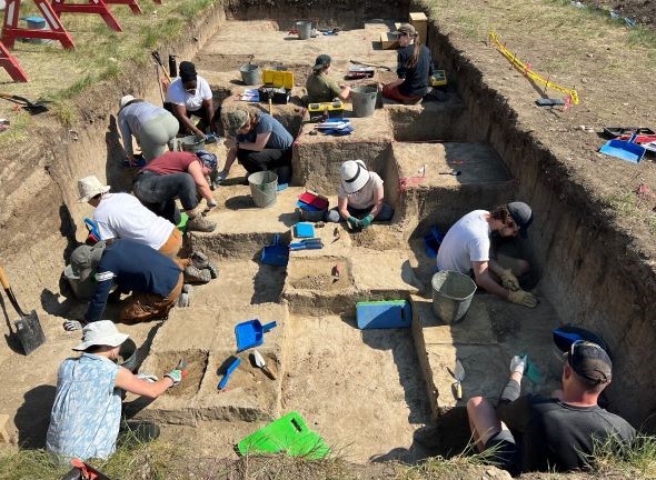
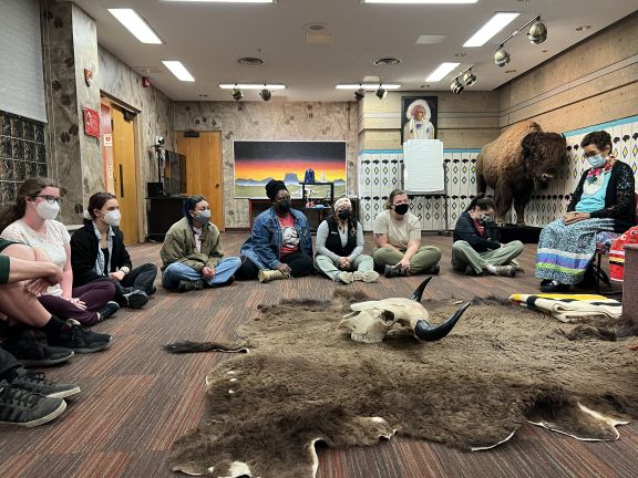
CANADA
UNIVERSITY OF NEW BRUNSWICK BIOARCHAEOLOGY FIELD SCHOOL AT THE FORTRESS OF LOUISBOURG, CAPE BRETON, NOVA SCOTIA
The only bioarchaeological field school of its kind in Canada
The Fortress of Louisbourg, a National Historic Site in Canada, boasts an impressive history that contributes to our understanding of life in Atlantic Canada during the 18th century.
Due to ongoing and imminent coastal erosion, this shared history is being lost at an alarming rate as archaeological material is being steadily destroyed.
Our research is designed to address ongoing erosional issues at the Fortress of Louisbourg by actively excavating and analyzing the individuals interred at Rochefort Point.
By rescuing these burials through a large scale, multi-year rescue excavation, there is a unique research opportunity to explore the lived experience of those who were part of the Louisbourg community while actively protecting their physical remains from certain destruction.
Partnership
A partnership was established in 2016 between UNB and Parks Canada to begin systematic excavation of Rochefort Point to protect the burials most at risk of coastal erosion. This partnership is significant in that both parties:
- work together towards a common goal of protecting these burials
- recognize this unique research opportunity to learn more about 18th-century life
- place high value on the dissemination of knowledge
- recognize the appeal of this work both locally and nationally
Preserve the past through a learning opportunity
As a reconstructed French colonial site, Parks Canada aims to bring the past to life at the Fortress of Louisbourg through its historical reenactments and focus on visitor experience through immersive programming.
This partnership supports these goals by preserving the past at the site through the rescue of these burials, but also creating exciting learning opportunities for the general public.
For UNB, the partnership enriches student experience and focuses on technical skill building, knowledge translation, ethics and research integrity.
As the only bioarchaeological field school of its kind in Canada, this program showcases UNB as an important contributor to the discipline and strives to become the primary training program for emerging bioarchaeological undergraduate and graduate students both nationally and internationally.
UNB’s Department of Anthropology, in partnership with Parks Canada, hosts the UNB Bioarchaeology Field School at the Fortress of Louisbourg National Historic Site of Canada.
This field school allows participants to gain:
- a hands-on field experience to complement undergraduate and graduate courses
- critical bioarchaeological training in skeletal recovery, analysis and ethical handling practices
- public engagement opportunities via social media and public outreach events
We will be accepting 15 students for the 2023 field school. Applications will be adjudicated based on GPA, statement of intent, and a short interview completed with the Project Director. Preference will be given to those who have completed a human osteology or skeletal biology university-level course at the time of application; however, these types of courses are not considered prerequisites.
Those not admitted to the program will be placed on a waiting list in case of cancellations.
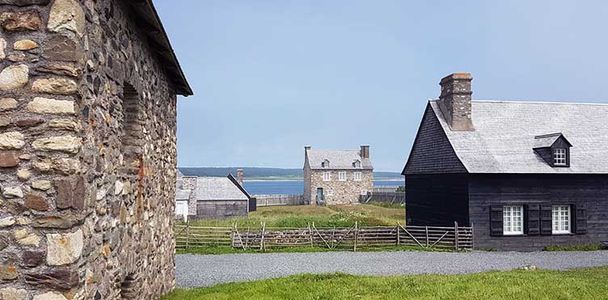
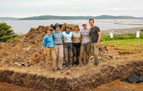
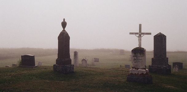
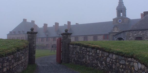
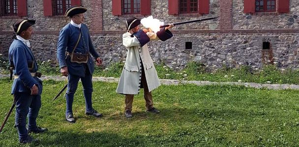
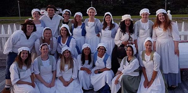
CHANNEL ISLANDS
2025 ISLAND ARCHAEOLOGY FIELD SCHOOL:
THE ARCHAEOLOGICAL MAP OF JERSEY (Channel Islands)
Dates: June 30 to July 19, 2025
Project website: https://www.jicas.ac.je/fieldschool
The 2025 JICAS Island Archaeology Field School in Jersey is run in partnership with Jersey Heritage, Societe Jersiaise and the University of Exeter’s International Summer School. This year’s Archaeological Map of Jersey Summer School will continue to focus on Approaches to Prehistoric Landscapes in Jersey, as well as a three-week excavation at the neolithic site La Hougue de Vinde.
Week one will cover mapping, recording and interpretation of the prehistoric record through geoarchaeological approaches. Outside of the classroom we will make use of Jersey diverse and dramatic landscape to explore different types of preservation context from Ice Age sediments of the foreshore to buried Neolithic landscapes.
Weeks two and three examine various field survey techniques, landscape archaeology and comparative island archaeology, as well as the known distribution of prehistoric sites from the Jersey Historic Environment Record and the new results of the recent LIDAR survey conducted on the island by Jersey Heritage. As part of the of ‘The Archaeological Map of Jersey’ project, weeks two and three will also continue the excavation work at La Hougue de Vinde as the basis of our planned field survey.
Cost: £799 for certificate (Jersey residents only) / £3,500 for credit (includes travel from UK to Jersey, accommodation, transportation, Jersey Neolithic dolmen tour, one-day trip to Guernsey, Channel Islands and all other cultural activities)
Pls email info@jicas.ac.je for an application form and complete prospectus with timetable.
Field School leader: Dr Matthew Pope (MCIfA. FSA.)
Dr Matthew Pope is Associate Professor in Palaeolithic archaeology at the UCL Institute of Archaeology. He leads multiple fieldwork projects spanning the last 600,000 years of the early human occupation record in Northern Europe. Over the last 13 years he has helped to lead the reexamination of the Paleolithic record of Jersey which has included excavations at La Cotte de St Brelade and Les Varines.
Field School leader: Dr Helen Dawson (MCIfA)
Dr Helen Dawson is adjunct professor at the Department of History and Culture at the University of Bologna, and associate research fellow at the Department of Prehistory at the Freie Universität Berlin. She has extensive fieldwork experience and a special interest in islands, which goes back to her first dig as an undergraduate in Barbados in 1997, followed by more fieldwork in the islands of the Mediterranean (Sicily, Cyprus, the Cyclades), a topic on which she has published widely.
Field School leader: Dr Hervé Duval (ACIfA)
Dr Hervé Duval is Field Archaeologist at the Société Jersiaise and associate research fellow to the UMR 6566, CReAAH, Rennes 1 University. Based in Jersey since 2022, he is in charge of developing research programs in the Channel Islands and promoting the work of the Archaeology Section. His research is mostly focused on Protohistory and he is both interested in island archaeology and erosion monitoring.
The Jersey International Centre of Advanced Studies Field School is a research-led centre of teaching and learning that focuses on all things islands. Located in the beautiful and culturally rich island of Jersey, Channel Islands, and other islands across Europe, the JICAS Field School offers both theoretical and skills-based courses that help prepare the next generation of practitioners and decision makers within the field of Island Studies.
At our 2025 Island Archaeology Summer School, we offer you the chance to work with academics and practitioners from leading UK and European universities to learn by observing, questioning and doing. Within these three-week field courses, we bring people together from across the world to explore the importance of island archaeology and why it matters. Our entire academic and fieldwork programme is aimed at ensuring that you can make the most of the opportunity to explore the world of island archaeology within an island context.
The 2025 JICAS Island Archaeology Field School in Jersey is run in partnership with Jersey Heritage, Société Jersiaise and the University of Exeter’s International Summer School. This year’s Archaeological Map of Jersey summer school will focus on Approaches to
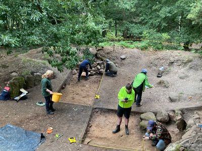

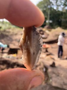
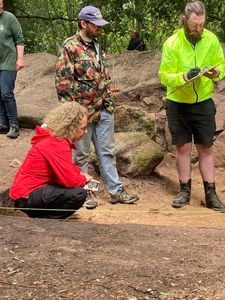
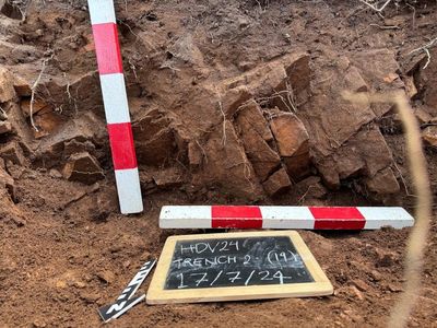

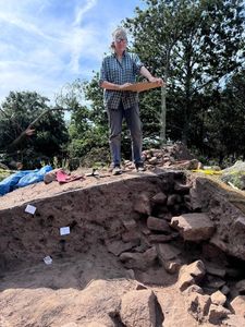
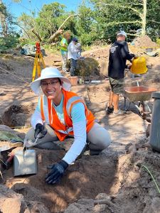
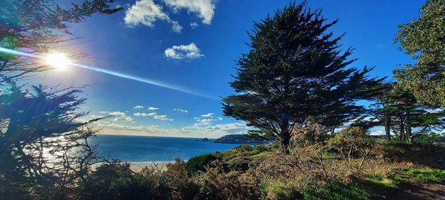
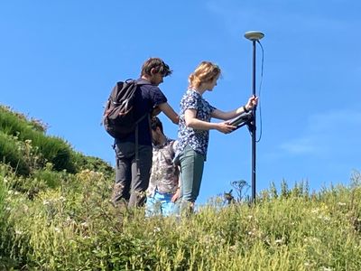
COLOMBIA
CARIBBEAN: PROVIDENCE ISLAND HERITAGE ARCHAEOLOGY (OLD PROVIDENCE & SANTA CATALINA ISLANDS, COLOMBIA)
DATES: June 7– July 2, 2025 Application deadline: Feb. 1, 2025
Project Website: https://ifrglobal.org/program/caribbean-providence-island/
Project videos: https://youtu.be/KAmP7huxAkM https://youtu.be/AWulrsk66As https://youtu.be/4CicyiUPuqo
Full program syllabus from 2024 season can be found here
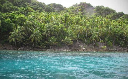
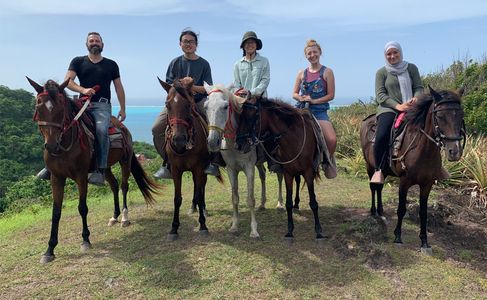
OVERVIEW
The islands of Old Providence and Santa Catalina -located 130 miles of the coast of Nicaragua and around 8.5 square miles in size- have been a center of global trade and commerce since the establishment of an English colony in 1629 and are still occupied by the Native Raizal descendants of the original colonists, African slaves, and members of a coterminous Maroon village to this day. Puritan venture capitalists financed the primary colonization of Old Providence and Santa Catalina –whose members arrived on the Seaflower, sister ship to the Mayflower– one year after the founding of the Massachusetts Bay Colony in what was to become the United States.
From 1629-1630, colonists, under the direction of the Providence Island Company, constructed an administrative center (the Town of New Westminster) and several forts, along with establishing dispersed, plantation-household groups known as ‘families’ that were supervised by a ‘father’ and comprised of wealthy Company investors, apprentices hoping to establish their own plantations, and enslaved Africans; while concurrently establishing colonies in Massachusetts Bay and later, the Eastern Caribbean. The area surrounding the original town, along with dispersed plantation-household groups, and at least one Maroon settlement ultimately evolved into distinct neighborhoods, which are still extant today. Since 1629, the Raizal have been episodically under the administration of England, Spain, English & French privateers, and Colombia.
Th
Th
This community-led Project seeks to assist ongoing Native Raizal efforts to untangle the complex culture history of Old Providence and Santa Catalina by collecting oral histories, studying historical documents, and archaeologically exploring three foundational landscapes: 1) the original town of New Westminster [1629] located on the northside of Old Providence Island, 2) a colonial-period Maroon community -made up of self-emancipated individuals- located on the south/southeast side of Old Providence island, and 3) the natural and modified gully systems & terrestrial pathways covering the Islands, utilized since 1629 for intra-island transportation and residential and agricultural water management.
To this end, archaeological and survey tasks focus on gaining a better understanding the Islands’ settlement timeline and understanding behavioral continuity and/or discontinuity, over time; and ethnographic research aims to document Native Raizal stories, art, & culture, catalog familial connections, better understand the Islands’ built-infrastructure and natural landscapes from emic perspectives, and record the English Criol language unique to the Archipelago of San Andrés for posterity.
The Program employs Native Raizal monitors who work with our teams every day and are present at all points of data collection: a cultural monitor, environmental monitor, and ethnographic monitor. Additionally, many people from the local Raizal community have been directly engaged in our research and teaching efforts. In 2018, the Program engaged a Native steering committee that includes government officials, teachers, scientists, artists, bush medicine specialists, and business owners. The committee was (and will continue to be) consulted on the Program and assisted in developing our core problem orientation, research questions, and research design. Of note, the Islands are located within a UNESCO biosphere, so the Program works closely with both Native Raizal and international UNESCO representatives because heritage and environmental conservation and sustainability go hand in hand.
PREREQUISITES
This field school has no prerequisites for participation, but suggest students do some background research about the Islands as well as look over the required and recommended readings before arriving in the field.
INVESTIGATION AREAS
Compared with the plethora of colonial-era, Spanish-controlled sites in the Western Caribbean, far fewer English settlements were established in the region. The Providence Island Company Colony is one of only a handful of English settlements that dotted the (Miskito) coast, south of the Yucatán, of which an even fewer number have been investigated archaeologically or ethnographically. Of note, there is (currently) little evidence of pre-European settlements on the Island, other than oral histories of Miskito Indians visiting the Island to fish and hunt turtles.
The 2024 field research season, the 4 th on the Islands, is focused on adding to the body of Western-Caribbean, English colonial-period data through archaeological investigations of a variety of locations throughout the Islands; in tandem with gaining a better understanding what the past means to the Native Raizal people who currently inhabit this space through ethnographic interviews and direct participant observation.
A major goal of archaeological and ethnographic data collection is centered on locating the original town of New Westminster and a conterminous Maroon Village, located on opposite sides of Old Providence Island; and gaining a better understanding of how people, infrastructure, and activities were organized on this landscape in the past. Oral histories and the documentary record, suggest that intercultural contacts and exchanges were frequent and the rivalries on the Islands were intense. Historical records indicate that English indentured servants frequently found common cause with enslaved Africans, often to the point of running away with them.
Another important question involves the construction styles of the houses on the Island. Providence Island was 10,500km from England, and the Island’s natural environment, being tropical, was far different from that of temperate England. The divergence between the English homeland and the Caribbean colony raises interesting questions about how—and how well—the English adapted to the unfamiliar biodiversity on the Island. History indicates that the Governor’s house may have been the only structure on the Island made entirely of brick. This means that the other houses were likely earth fast, wooden structures commonly built at seventeenth-century English colonial settlements, but this will need to be archaeologically verified.
In addition to locating historical built environments and structures, the Program has been tasked by our Native steering committee to map the Islands’ water gullies and terrestrial pathways. The Islands’ gullies (originating in the mountains and ending at the sea) are not only a source of fresh water…the gullies, along with terrestrial routes covering the Islands, were used as the main travel corridors around the Islands until the main road was paved in the 1980s and are still used today. Mapping these routes will give us vital clues to the movement of people, information, and materials on the Islands, over time; and will likely lead to the discovery of currently unknown residential and agricultural sites, based on prime locations at the intersections of these formerly main ‘roads’.
Lastly, the Program seeks to understand what the past means to the extant Native Raizal population and how the geographic location and unique environmental biome shapes lifeways, now and in the past – what practices survive (or not) from the early days of the Colony and why. We will be working directly with the community in a variety of ways, so students will not only be able to handle archaeological materials, but will also be able to interact with the living descendants of the past we are studying. Moving between these ‘worlds’ is key to modern-world archaeology because we cannot understand the past properly without having an understanding of the current stakeholders (true inheritors) of that past.
来
FIELD SCHOOL DIRECTOR(S)
Dr. Tracie Mayfield (RPA #4754), Department of Anthropology, University of Southern California (email: <traciemayfield@me.com>)
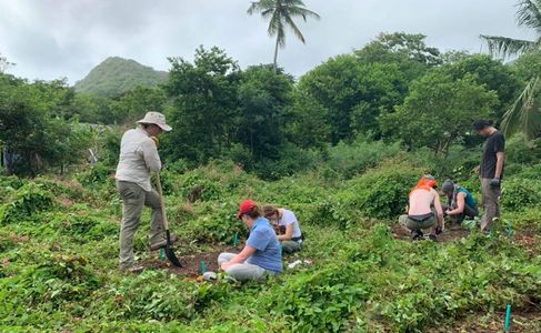
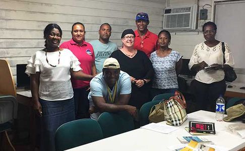
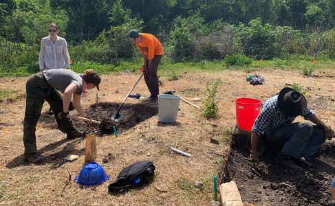
CHINA
Western Zhou Excavations at Liulihe, (near Beijing, China)
Dates: June 9 to July 16, 2025 Application deadline: Feb. 1, 2025
Project website: https://ifrglobal.org/program/china-liulihe/
Project syllabus: https://ifrglobal.org/wp-content/uploads/2024/02/Syllabus-China-Liulihe-2024-updated.pdf
OVERVIEW
The Liulihe site in Beijing is a Chinese Bronze Age city dang from about 2,800-3,000 years ago. Remains at the site include rammed-earth city walls, moats, large rammed-earth buildings (palaces or ancestral temples), small above-ground buildings, crypts and semi-crypts, ceremonial relics, and burials of various grades.
Numerous excavated inscriptions indicate that the site was the capital city of the state of Yan, one of the most northerly feudal states of the Western Zhou period, as recorded in the literature. Artifacts reflecting the highest level of productivity and aesthetics of the me, such as bronze, jade, lacquer, and primitive porcelain, were unearthed from the aristocratic tombs at the Liulihe site. The study of pottery can show that there were people of different origins mixing here at the Liulihe site and distributed in different classes.
The site has been known since 1945, and excavation and research work has been carried out since 2019. The main research objectives of this phase of the Liulihe site are focused on early urban planning and layout, architectural forms and assemblage relationships of major buildings, and archaeological research on burials, with the types of excavations including dwelling sites and burials.
The content of the summer school is real fieldwork and excavation operations, which contribute to the overall project goals. The excavation sites we use for the summer school have a certain degree of continuity, and have been selected, investigated and test excavated beforehand to ensure that the students’ internships will be productive.
Students will mainly participate in the excavation, drawing, sampling and recording of tombs, as well as archaeological survey, exploration, recording, and data collation and uploading in other parts of the broader urban project. Teachers will live with students to facilitate communication. During the internship, students will be involved in excavation work under the guidance of their teachers and can ask them questions at any me. Teachers encourage and support students to actively express their views and opinions, and to make rational suggestions. The programme hopes to establish a close relationship between students and research work, and to improve their research ability and interest in participating in research. Outside of work and study, we will lead a visit to the World Heritage Site of the Zhoukoudian Homo erectus site and participate in the Great Wall conservation and restoration survey. Participants may be involved in public outreach or science popularization activities.
PREREQUISITES
There are no prerequisites at this eld school. While an introduction to archaeology and anthropology courses (including an overview course on the Bronze Age in East Asia) would be helpful, it is not necessary. As this is a eld-based learning environment, students should understand that they will be exposed to environments and physical labour that they may not be used to on a daily basis.
COURSE OBJECTIVES
The main goal is for the students to master the theory, techniques and methods of Chinese eld archaeology through a typical archaeological excavation of a large Chinese site, and at the same me to make some contributions to our real research work.
In the process, we will allow students to learn the techniques of archaeological exploration, excavation, recording, collecting, data cleaning, pottery classification and statistics. Students will have the opportunity to engage with some Chinese Bronze Age archaeology and learn about early Chinese urban features. In addition, students will learn how to discuss how to develop urban archaeological work and how to beer tell stories through archaeological work. Students will learn how to set academic goals, interpret phenomena, and work beer as a team.
TEACHING TEAM BACKGROUND
Two staff train the students to learn core skills for the whole program, and two other staff who own master’s degrees in English-speaking countries help students to complete relevant international formalities and help overcome communication obstacles between international students and Chinese teachers, and students. These four team members are all female. There will be a professional vocabulary booklet in both Chinese and English for students and teachers to communicate, reducing misperceptions about the excavation command.
CHINA
Early Bronze Age Excavations at Panlongcheng (Wuhan, Hubei Province, China)
Dates: June 22 to July 26, 2025 Application deadline: Feb. 1, 2025
Project website: https://www.archaeological.org/fieldwork/china-panlongcheng-excavation-ifr/
Project syllabus: https://ifrglobal.org/wp-content/uploads/2024/02/Syllabus-China-Liulihe-2024-updated.pdf
Project Description:

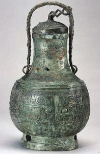
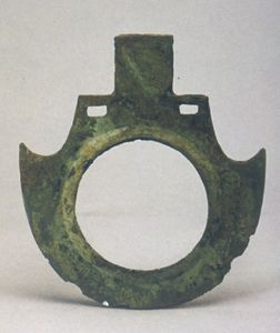

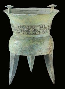


Step into the captivating world of Xia and Shang Dynasty-era China as you join the Panlongcheng Archaeological Field School. Situated in the verdant outskirts of central China’s bustling metropolis of Wuhan, Panlongcheng is a national cultural heritage park boasting a rich history dating back to the early Bronze Age. In this hands-on summer program, you’ll delve into the landscape, daily life, and social organization of this ancient urban settlement, the largest city of its time in the middle reaches of the Yangtze River. Through field excavations, lab work, and data analysis, you’ll contribute invaluable insights into the early Bronze Age civilization of the Yangtze River Valley while honing your skills as a researcher.
Project Directors:
Prof. Changping Zhang & Dr. Zhuo Sun
CHINA
Middle-to-Late Neolithic Excavations at Yangguanzhai (near Xi’an, Shaanxi Province, China)
Dates: June 15 to July 19, 2025 Application deadline: Feb. 1, 2025
Project website: https://ifrglobal.org/program/china-yangguanzhai/
Project syllabus (from 2024 season): https://ifrglobal.org/wp-content/uploads/2023/11/Syllabus-China-YGZ-2024-updated.docx.pdf
OVERVIEW
The prehistoric village of Yangguanzhai (YGZ) dates to the Middle to Late Yangshao period (3200-3,000 BCE). It is one of the largest settlements of its kind. The site is located in the Jing River Valley, approximately 25 kilometers north of the ancient city of Xi’an in northwest China. Since 2004, in preparation for a major construction project, the Shaanxi Provincial Institute of Archaeology began to conduct large-scale excavations and exploratory surveys – by means of test trenches and coring with the Luoyang spade – in various parts of the site. More than 18,000 square meters have been excavated to date. These activities revealed a moat, a row of cave dwellings, subterranean houses, child urn burials in the residential areas, and numerous pottery kilns. The quantity and quality of finds were impressive enough for the Chinese authorities to halt commercial development and declare the area a protected archaeological site.
In 2010, as part of the ongoing excavation, a joint UCLA/Shaanxi Academy of Archaeology/Xibei University project began to operate at the site. This project is shifting the focus from the large-scale exposure of architecture to a more careful and systematic analysis of local stratigraphy and a stronger emphasis on anthropological interpretations. More recently, researchers from the Shaanxi Academy of Archaeology have discovered an extensive cemetery at the site, the only known cemetery so far dating to the Miaodigou Period (4 th millennium BC).
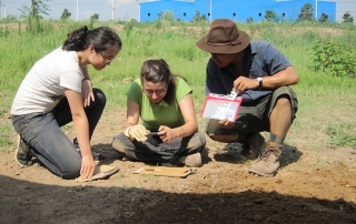
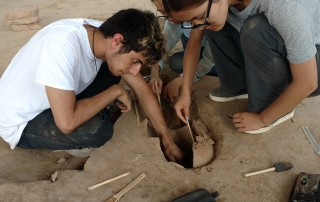
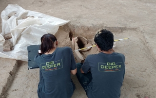
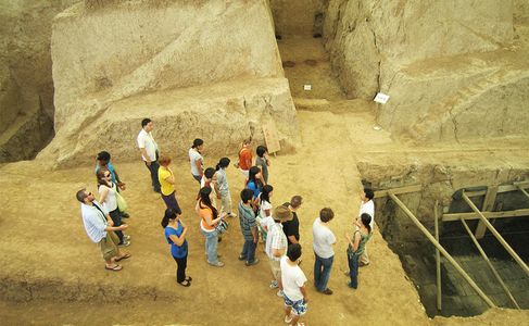
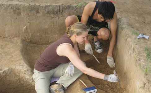
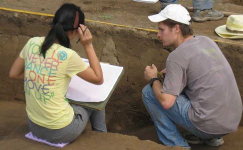
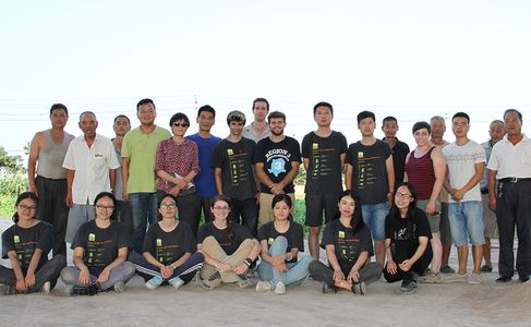
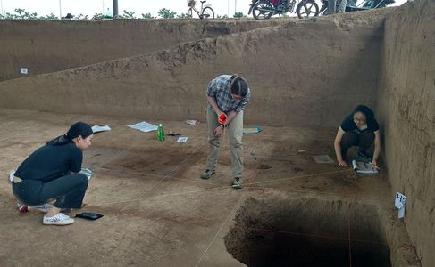
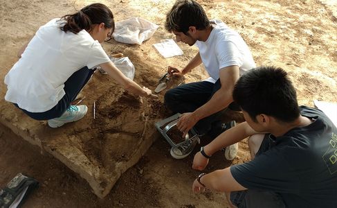
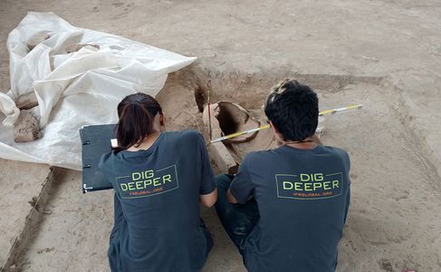
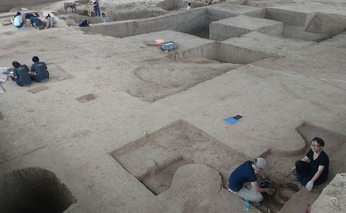
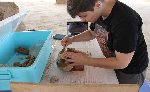
在
Although full understanding of Yangguanzhai still eludes us, a clearer picture has begun to emerge. Based on research into the formation processes of the moat and one of the pits excavated by the IFR field school, preliminary site formation models have been formulated. Results from the analysis of micromorphological samples suggests that the function of the moat has changed from “potentially defensive or symbolic in nature” (M. Fox 2016) to a refuse dump. Both environmental factors, particularly water-related effects, and anthropogenic actions were responsible for these developments. However, the reasons behind the changes in human behavior throughout the occupation history of the site are still unclear.
Test results and 14C dates indicate the existence of a long-lasting farming community at Yangguanzhai. The community subsisted on millet cultivation, husbandry of pigs, wild animal hunting, fishing, and wild plant gathering. Yangguanzhai’s inhabitants also invested heavily in ceramic manufacture, demonstrated not only by the enormous amount of pottery sherds discovered at the site, but the remaining kilns found in all seven excavated sectors at Yangguanzhai. Unlike earlier Neolithic villages, where ceramic manufacturing was separated from the village in adjacent locations, the ceramic kilns found in Yangguanzhai are next to or built within residential areas. Imported ceramics such as white paste rings, either plain or painted with red colored patterns, attest to the fact that long distance contacts with other regions was commonplace.
Wh
在
The Yangguanzhai project provides not only training in field excavation, but also a full exposure to Chinese archaeology through lectures and visits to museums and archaeological sites of various periods. In addition, it provides opportunities for students to interact on a daily basis with Chinese students and to work closely with highly experienced Chinese archaeologists.
FIELD SCHOOL DIRECTOR(S)
Dr. Li Yue, Xibei University, China (liyue0114@gmail.com)
Dr. Zhai Linlin, Xibei University, China (641055200@qq.com)
Dr. Sun Zhouyong, Shaanxi Academy of Archaeology, China (sunzhouyong2005@yahoo.cn)
Mr. Yang Liping, Shaanxi Academy of Archaeology, China (ylp-arch@163.com)
CROATIA
EXCAVATIONS AT SALONA, CROATIA: THE ROMAN CAPITAL OF THE EASTERN ADRIATIC (Salona, Croatia)
Dates: Sept. 14 to October 11, 2025
Project website: https://www.fieldsciences.org/program/2025-croatia-salona/
Project syllabus: https://www.fieldsciences.org/wp-content/uploads/2024/11/Syllabus-Croatia-Salona-2025.pdf
OVERVIEW
Salona was the capital of the province of Dalmatia and the most important Roman site on the Eastern Adriatic. As a Roman colony, it was established in the 1st century BCE, and it lasted until 7th century CE when raids from Avar and Slavic peoples conquered Salona and forced its inhabitants to flee. It is probably the only provincial capital that didn’t develop into a medieval and, consequently, a modern city. Instead, the royal medieval city of Solin was founded at the eastern outskirts of Roman Salona, whose remains served as a quarry for not just Solin and surrounding places, but also for Split and even as far as Venice.
Salona has been excavated for more than 200 years. Yet most of the Roman city area – about 80% — is still unexcavated and unknown. There is much we need to know about Salona, including its building sequence, its integration of local population with Italian Romans, and its economic and political organization and institutions.
Our program is focused on digging at two distinct locations. The first area (Site 1) is a late antiquity building complex, dated to the 4-6 Centuries CE, with enigmatic design and unknown function. The second area (Site 2) is focused on the towers dotting the city’s walls, dated to the 2-4 centuries CE. To elevate the floor within the towers, the builders brought soil rich with ceramics from elsewhere at Salona (likely the nearby cemetery), creating a highly packed time capsule.
Both locations are rich in archaeological material, primarily pottery. They also contain other materials typical to a Roman city, including stone inscriptions and human remains. The first excavation location offers more complex stratigraphy, attesting to at least four centuries of using the same space (pre Roman and Roman periods), with the remains of several buildings from different occupation levels. The second excavation location offers a unique experience of understanding the building technique of a defensive tower. Namely, the layer below the floor surface consists of intentionally placed archaeological material. Because of that, we need to sift all the dirt we excavate, which brings to light not only pottery, bones and shells, but also many items that can be interpreted as personal belongings and grave goods.
PROGRAM DESCRIPTION
Salona was the capital of the province of Dalmatia and the most important Roman site on the Eastern Adriatic. As a Roman colony, it was established in the 1st century BCE, and it lasted until 7 th century CE when raids from Avar and Slavic peoples conquered Salona and forced its inhabitants to flee. It is probably the only provincial capital that didn’t develop into a medieval and, consequently, a modern city. Instead, the royal medieval city of Solin was founded at the eastern outskirts of Roman Salona, whose remains served as a quarry for not just Solin and surrounding places, but also for Split and even as far as Venice.
Salona has been excavated for more than 200 years. Yet most of the Roman city area – about 80% — is still unexcavated and unknown. There is much we need to know about Salona, including its building sequence, its integration of local population with Italian Romans, and its economic and political organization and institutions.
Our program is focused on digging at two distinct locations. The first area (Site 1) is a late antiquity building complex, dated to the 4-6 Centuries CE, with enigmatic design and unknown function. The second area (Site 2) is focused on the towers dotting the city’s walls, dated to the 2-4 centuries CE. To elevate the floor within the towers, the builders brought soil rich with ceramics from elsewhere at Salona (likely the nearby cemetery), creating a highly packed time capsule.
Both locations are rich in archaeological material, primarily pottery. They also contain other materials typical to a Roman city, including stone inscriptions and human remains. The first excavation location offers more complex stratigraphy, attesting to at least four centuries of using the same space (pre Roman and Roman periods), with the remains of several buildings from different occupation levels. The second excavation location offers a unique experience of understanding the building technique of a defensive tower. Namely, the layer below the floor surface consists of intentionally placed archaeological material. Because of that, we need to sift all the dirt we excavate, which brings to light not only pottery, bones and shells, but also many items that can be interpreted as personal belongings and grave goods.
This program provides basic practical archaeological training for international and Croatian students. Our emphasis is on archaeological field methods and practices. Students will learn how to excavate complex stratigraphic contexts and utilize a broad range of archaeological tools. Students will also learn how to sieve, sort and recognize various types of archaeological artifacts, and learn how to properly observe and document the excavation process. Finally, students will use the latest spatial technology and create plans and maps using differential GPS and Photogrammetry.
COURSE OBJECTIVES
By the end of the program, students will develop an in-depth, interdisciplinary understanding of archaeological excavation methods and practices. Students will learn how to scientifically excavate, analyze and interpret material culture. Students will also learn how to identify, date and classify Roman architecture and artifacts. The main purpose of this program is to enable participants to develop competencies and strategies for working at archaeological sites in various contexts and at multiple scales.
From a methodological perspective, fieldwork includes three main aspects:
Excavation: The goal of the excavation is the retrieval of artifacts, ecofacts and features within the archaeological context. Participants will be trained in the specific excavation and analysis tasks as well as in the general objectives of the excavation and its research design.
Work with recovered material culture and Lab Work: This is a key part of our archaeological strategy and includes inventory, classification and initial study of the artifacts, bones and archaeological structures found at the site. Project staff will train participants in the study of materials retrieved during excavation. Each day, we will discuss the activities to be performed and the results that are being obtained to plan for the work ahead and to fully involve participants in the project.
Lectures: Activities will be complemented with occasional lectures, at least once per week. Lectures will be 45-60 minutes each and presented by staff.
DIRECTOR: Dr. Dino Demicheli, Associate Professor at the Department of Archaeology, University of Zagreb (ddemiche@ffzg.hr)
CROATIA
THE LOBOR ARCHAEOLOGICAL and BIOARCHAEOLOGICAL PROJECT, CROATIA
Date: June 15 to July 12, 2025 Priority deadline: February 1, 2025
Project website: https://www.archaeological.org/fieldwork/croatia-lobor/
Project flyer: https://www.archaeological.org/wp-content/uploads/2024/01/IFR-Croatia-Program-Sheet.pdf
Project Description:
Connect with humans from late antiquity through the early Middle Ages as you make your mark on an excavation that has been operating for over 25 years. Help uncover the mysteries of the sacred site of Lobor, which has long been associated with female religious icons, including a previous Roman temple dedicated to Diana and multiple churches dedicated to the worship of the Virgin Mary. You’ll help researchers understand more about the location’s importance from the 5th through the 12th century AD by excavating the graveyard and fortification walls surrounding the existing church, and will help shape what we know about daily life of its inhabitants through the study of human remains from the site.
Field school highlights:
- Gain practical hands-on experience that translates to any excavation site including digging techniques, sieving, surveying, documentation and more.
- Learn to identify human bones and deduce aspects of their lives and communities such as sex, age, diet, class, and more.
- Work alongside local university students from Croatia and create international friendships.
Overview (from Summer 2024 field school description)
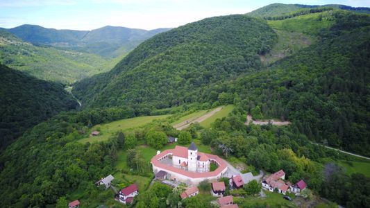 罗
罗
The churches are surrounded by a cemetery with burials dating back to prehistoric times and up to the 19th century. Every year, research into one part of the cemetery is conducted. Students learn the process of determining the area of a burial, cleaning the skeletons in the soil, drawing, photography, dealing with in situ finds, removing and packing the bones, and laboratory analysis of skeletons. The Bioarchaeological School at Lobor began is 2016 as the Croatian Science Foundation project. The projects aims to reconstruct the profile of communities that lived in the area, from trauma analysis to DNA and facial reconstruction of individual skeletons.
FIELD SCHOOL DIRECTORS
Dr. Krešimir Filipec, Professor and Director of at the Department of Medieval Archaeology, Faculty of Humanities and Social Sciences, University of Zagreb (Croatia) (kfilipec@ffzg.hr)
Ms. Jana Škrgulja, Assistant Professor at the Department of Archaeology, Faculty of Humanities and Social Sciences, University of Zagreb (Croatia) (jana.skrgulja@gmail.com, jskrgulj@ffzg.hr)
This field school is one of many operated in collaboration with the Institute for Field Research (IFR)
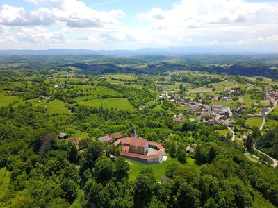

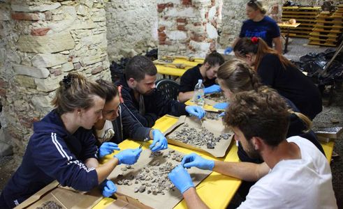
CYPRUS
The Makounta-Voules Archaeological Project: Exploring a prehistoric settlement in northwestern Cyprus (Polis (Polis Chrysochous),
Makounta, and Nicosia, Cyprus)
Dates: June 11 to July 19, 2025 Regular Decision Program Application Deadline: February 5, 2025
Project website: https://makountavoules.com/
Project application: https://packabroad.ncsu.edu/index.cfm?FuseAction=Programs.ViewProgramAngular&id=3723
The Makounta-Voules Archaeological Project is a collaborative, international research project investigating the backstory to urbanization in prehistoric Cyprus. The site of Makounta-Voules–Mersinoudia (previously investigated and published by Dariusz Maliszewski as Makounta-Mersinoudhia) is a prehistoric settlement in the northwestern part of the island, where few prehistoric sites have been excavated. Our team is exploring the evolving relationship between copper exploitation, long-distance trade, agricultural intensification, and increasing social inequality during the Late Chalcolithic period, Early Bronze Age, and Middle Bronze Age, immediately before the first urban centers emerged on the island.
Program Overview
The island of Cyprus, legendary birthplace of the goddess Aphrodite, lies at the eastern end of the Mediterranean Sea. The Republic of Cyprus is a member of the European Union and is a popular tourist destination that offers dramatic landscapes, pristine beaches, a vibrant cultural scene, and world-famous archaeological sites. Archaeologists working on the island have uncovered abundant evidence for a rich and complex past that stretches back into deep prehistory. Students in the program will take part in archaeological excavations at the prehistoric site of Makounta-Voules-Mersinoudia, located in western Cyprus in the foothills of the Troodos mountains near the coastal town of Polis. Students will also embark on weekly trips to visit archaeological sites across the island, including the sprawling Classical city of Kourion, the sanctuary of Aphrodite at Palaepaphos, and the UNESCO World Heritage Sites of Khirokitia, Paphos, and the painted churches of the Troodos.
ACADEMICS
Students will receive daily, hands-on instruction in archaeological field methods and will explore the archaeology of Cyprus – as well as archaeological method and theory more broadly – through field trips, reading/writing assignments, and a series of evening lectures. Students are encouraged to enroll in both ANT 389 (3 credit hours) and HI 395 (3 credit hours), but they may choose to enroll in one or the other of these courses. Both courses include prerequisites, but these may be waived with the permission of the instructor.
PROJECT DATES
Students should arrive in the town of Polis, Cyprus, on June 12, 2024, and depart July 19, 2024. If you wish to arrive earlier or stay later, please contact the project director to make additional lodging arrangements.
LOCATION
We will be living in the town of Polis (Paphos District, Cyprus), a short drive from the site of Makounta-Voules-Mersinoudia.
Contact
For more information, please email one of the project collaborators:
Dr. Kathryn Grossman (kmgrossman@ncsu.edu)
Dr. Tate Paulette (tatepaulette@ncsu.edu)
Dr. Lisa Graham (lgraham2@exseed.ed.ac.uk)
Dr. Andrew McCarthy (A.P.McCarthy@ed.ac.uk)
DENMARK
VASAGARD ARCHAEOLOGICAL PROJECT, Bornholm Island, Denmark
Dates: June 3 to June 28, 2024 Priority deadline: February 1, 2024
Project website https://ifrglobal.org/program/denmark-vasagard/
Full program syllabus for 2024 can be found here
FIELD SCHOOL DIRECTORS
Dr. Finn Ole Nielsen, BARC-Bornholm Museum, Denmark (fon@bornholmsmuseer.dk)
Dr. M. Nicolás Caretta, BARC-Bornholm Museum, Denmark (nc@bornholmsmuseum.dk) MSc.
Michael Thorsen, BARC-Bornholm Museum, Denmark (mst@bornholmsmuseum.dk) MSc.
Ditte Kofod, BARC-Bornholm Museum, Denmark (ditte.kofod@icloud.com)
OVERVIEW
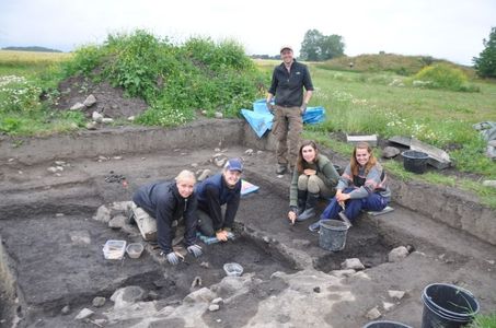 Neolithic settlements are among the most frequent types of prehistoric sites. Yet few have been investigated in the Baltic region. Scholars have incomplete understanding of how Neolithic sites were built, how different parts functioned and what activities took place, or how circular structures (identified through timber post holes in a circular form) had developed. This project aims to investigate these issues at Vasagård, a settlement on the island of Bornholm (Denmark) that corresponds chronologically to the Neolithic period c. 3500-2700 BCE.
The Neolithic dwellings at Vasagård and cultural layers fall broadly into two periods: (1) Early Neolithic B/C to Late Funnel Beaker culture; and (2) Middle Neolithic A-V to Middle Neolithic B-I. The Vasagård Archaeological Project aims to seek more detailed answers to specific questions at the sites and from those, to extrapolate about cultural traditions at the Baltic and North European Neolithic Period. Our goal is not only to explore the richness of the archaeological materials found on Vasagård but also the type and history of interactions among different groups/farming communities in the Baltic, their technology, economy, religion, and social organization.
 Vasagård is divided into two distinct sections: (a) Section West with a tomb system, where a dolmen and a passage grave are present and (b) Section East with a settlement system. It is important to note that the proximity of a causewayed enclosure, graves and settlement is unique to the period. During the 2007 excavations of the East and West Enclosures, it was determined that the grave system was replaced by a stockade. The East Enclosure enclosed an approximately 4-hectare area and West Enclosure, a somewhat larger with about 7 hectares area. On each side at least 6 palisades and 3 phases of construction can be detected. Inside and within the palisade fence there is a settlement with traces of burnt offerings – cereal, bones and flint tools. So far, no traces of the characteristic two-aisled longhouses were identified; however, traces of at least 9 circular timber circles were found, seven on the east and two in the West site, but there are certainly more.
During excavations in 2013-2018, nearly 300 broken and complete flat stones were recovered, engraved with patterns of radiating straight lines. Dubbed ‘sun stones’ or ‘solar stones’, archaeologists at the Bornholm Museum dated those to c. 2900 BCE. They suggested that these artifacts were part of rituals carried out by Neolithic sun-worshippers. Other engraved stones include symbolic maps of local landscapes, and these were possibly used in rituals by individuals who hoped to magically influence the sun and thus fertility of their farmlands. Our current working hypothesis is that Vasagård was established by a group of early farmers who constructed a fenced stronghold with one public building, possibly a temple. The ornamented wall of the temple can be compared with similar finds at the site of Schalkenburg in Sachsen-Anhalt (Germany), suggesting ritual use.
如果
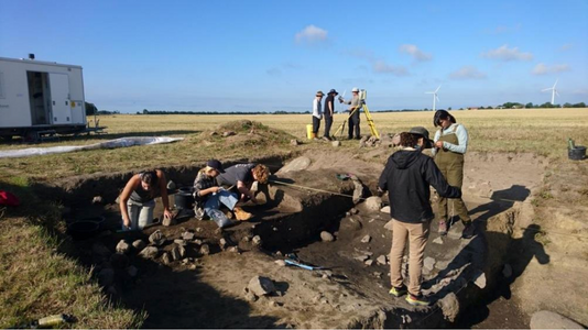
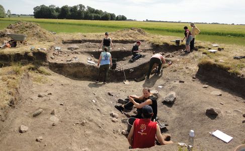
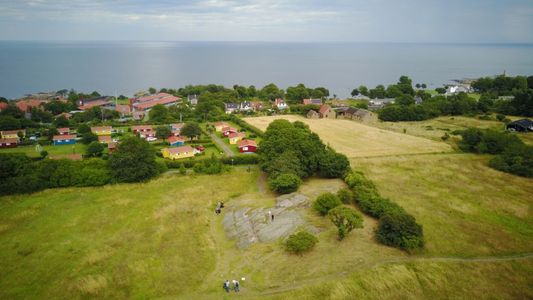
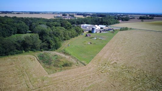
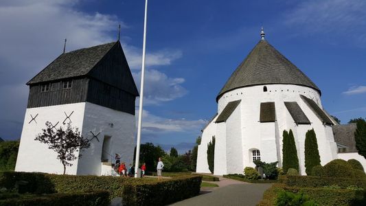
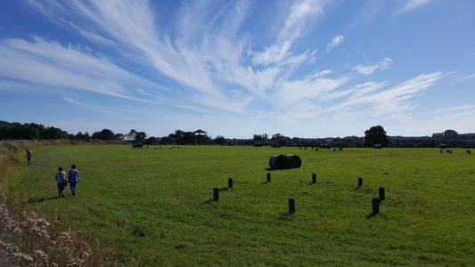
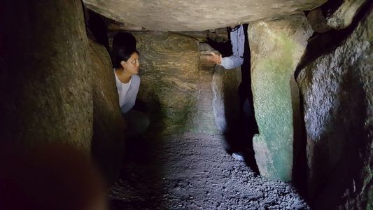
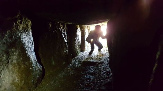
ECUADOR
Pambamarca Archaeology Project: Inka Fortresses and Communities in Ecuador (Cangahua, Ecuador)
Dates: June 28 to July 18, 2025
Project websites: https://www.foothill.edu/anthropology/field/ecuador.html and https://sites.google.com/view/pambamarca/home
Project videos: https://www.tiktok.com/@marisolcharro_/video/7387469007797882118 and https://drive.google.com/file/d/14v15BLuHYRo93a9l8QL_lO61uRbBD5AV/view?usp=sharing
Preliminary Summer 2025 application: https://forms.gle/5Quty175em8ioF5v6
You want to be here. The community partners we work with are excited to have us return to continue the work. Our 2025 program will involve mostly local community service, reconnaissance and lab organization in July. Students would enroll in a 4-unit Applied Anthropology course that would allow for introductions to the region and development of future research plans.; and they will enroll in a 2-unit Laboratory Methods course that will cover the basics of artifact analysis as we continue to uncover clues to the legendary history of the area. Ecuador was a land of incredible resistance to colonial forces. Indigenous Quichua speaking peoples managed to hold off the Inka, the Spanish, and now multi-national corporations since the 1400s. Is it the water? The climate? What is it about the peoples of the paramo (high grasslands) that gives them the ability to continue in the face of blatant imperialism.
If you are interested please fill out the preliminary application so we can contact you directly with more information. Thanks!
Below see the information from our 2 week program in 2023, the summer 2025 will be similar in structure.
PRELIMINARY 2025 APPLICATION HERE
Discover with us the beauty of Ecuador as we continue our investigation of the landscapes surrounding the Pre-Columbian sites of Pambamarca. Join us in South America this summer for an excellent archaeology and cultural experience with course work and field trips.
Live with us and other project members in the Andes.
Learn about all aspects of the research project, including archaeological survey and excavation and community development activities, but the focus will be on laboratory work.
Days will be spent immersed in the culture of Ecuador both past and present. To learn about the past the student will learn the basic field techniques of archaeology, including excavation, survey and laboratory analysis. Classwork will cover some archaeology methods and theory, as well as South American archaeology and history. For more details about our research and the past findings, please see the Pambamarca project website and the bibliography section below.
Field trips for students will be called Faculty Developed Practica (FDP) designed to foster intercultural knowledge. Students will be required to take part in these trips. For example students will travel to indigenous communities, market towns, ancient archaeological sites and museums.
We are a short ride to the town of Cayambe, and a little over an hour from Quito on the weekends. Also, the world famous artisans and market of Otavalo are located only a half hour to the north. Buses are cheap and direct. For the adventurous, the headwaters of the Amazon River, the majestic Pacific coastline, and even the Galapagos Islands are a short plane trip away. Ecuador is a truly remarkable place, and we are excited to share its wonders with you, and meanwhile to do some really interesting archaeology!
Description of the Archaeology
The Pambamarca project area contains the largest concentration of pre-Columbian forts in the New World (Hyslop 1990). We have been working here since 2001 excavating and surveying at the forts. We know from the Spanish chroniclers that the Inca Empire tried to conquer the Ecuadorian people beginning around 1490 and that the people of Ecuador put up a famous resistance which forced the Inca to construct fortresses over many years until finally the conquest ended in the murder of most of the Ecuadorian army at Lago Yaguarcocha or the Lake of Blood. The purpose of our study is to examine the sequence of occupation and activity in and around Pambamarca. What we have found out so far is that
- Evidence for warfare is everywhere
- People built these sites at different times and for different purposes.
- There are different kinds of sites in the Pambamarca complex, including castle-like pucara (Inca forts) and other non-military sites that seem to be more religious and less military.
- There are roads connecting all the sites.
- We need to learn so much more!
Our work in 2025 will continue researching these amazing sites and expand our survey in the Andean highlands. Our aim is to document all of the sites and find out why so many forts were built in this critical geographic location. In addition, we hope to uncover the differences between the Inka and Cayambe warfare tactics. Finally, we will be trying to understand what made the Cayambe so successful at resisting the Inka when the rest of South America fell so quickly.
Student field work typically begins at a Spanish era colonial hacienda where we learn field techniques, and quickly move to the other sites for the rest of the field season. Plans in 2025 will include analysis of artifacts from excavations at important Cayambe sites and Inka fortresses. Preliminary survey and exploration of ancient road systems will continue into the Amazon basin.
Students are trained in laboratory analysis this summer. Our typical student this summer may be someone with previous experience in survey and excavation who would like to be in the lab for a few weeks, or you simply want to come to Ecuador and learn about archaeology and anthropology! The project also utilizes Ground Penetrating Radar (GPR) to detect subsurface features and uses a Geographic Information System (GIS) to analyze data, but this summer we will not have the GPR in country, although we are planning a 3D photogrammetry project that students will be involved in.
Description of the Indigenous Anthropology
For too long archaeologists have been involving themselves in research without a coherent plan for using anthropology to work with the local peoples in different capacities. This summer we will be working closely with Ecuadorian community members who are interested in putting together a local museum. Students who are interested in aspects of public archaeology will be working closely with the project directors and the community members to create a shared vision for a permanent installation within the town of Cangahua. These are exciting times to be a part of the program.
Course Descriptions
All participants must commit to active and positive engagement in all program components. Students will earn 6 units of credit from Foothill College for successful completion of the program. The classes you will be taking are ANTH12 – Applied Anthropology (4-units) and ANTH17L – Intermediate Archaeology Laboratory Methods (2-units). Both of these courses are fully transferrable to your universities.
The field program is broken down into different parts and everything will be very accelerated. The field and lab training portions of the program involve all the aspects of archaeology, preparing the student to operate in a field archaeology environment anywhere in the world. Benefiting from the over 100 years combined staff experience in teaching archaeology, each student is instructed in methods of site reconnaissance, surveying, excavation techniques, data recording, photography, and drawing. In the laboratory, students are guided through different aspects of artifact analysis, such as ceramic typology and stone tool production experiments.
A field journal will be covering every day in the field will be handed in by the student to the professors. The journal will cover the research being conducted and critically analyze the experience as it is ongoing. We find it is important for our students to reflect upon the daily rhythm of their lives. We will also require one or two blog posts during the trip.
Contact information
Dr. Samuel Connell, Department of Anthropology, Foothill College, 12345 El Monte Rd., Los Altos Hills, CA 94022 USA
(650) 949-7197 connellsamuel@foothill.edu
DO NOT HESITATE TO EMAIL OR CALL IF YOU HAVE ANY QUESTIONS!!!
EGYPT
Tell Timai Archaeological Project (Timai El Amdid, Egypt)
Dates: June 16, 2025 to July 25, 2025
Project websites: https://www.telltimai.org/
Project videos: https://telltimai.org/html/multimedia.html
Overview:
Th
About the Tell Timai Archaeological Project
Tell Timai, the ancient city of Thmuis, is a rare example of a well-preserved Graeco-Roman City in the Nile Delta. The urban center is nearly complete and offers an exceptional opportunity to study all aspects of life, business, religion, and administration during the Ptolemaic and Roman periods. Mudbrick architecture is rarely preserved in the Delta, making Tell Timai a unique piece of Egyptian history. Unfortunately the site is under considerable threat from encroachment, erosion, and looting. Since 2007, the Tell Timai Project of the University of Hawaii has embraced the concepts of Research, Conservation, and Education and has undertaken the tasks of studying the city to save it as an important piece of Egyptian patrimony and world history. The ultimate goal is to create a site worthy of drawing tourism to the Eastern Delta and combining the site with neighboring Mendes to create a World Heritage Archaeological Zone.
The ambitious goals of the Tell Timai Project are beyond the means of any one institution. We have a philosophy that this work will only be successful if it is a cooperative effort between international scholars and institutions, Egyptian archaeological institutions, the Ministry of State Antiquities/Supreme Council of Antiquities, and the people who live in the vicinity of the Tell Timai-Mendes Archaeological Zone.
History of the Ancient City of Thmuis
Th
History of excavations at Tell Timai
Since 2007, the Tell Timai Project of the University of Hawaii has embraced the concepts of Research, Conservation, and Education and has undertaken the tasks of studying the city to save it as an important piece of Egyptian patrimony and world history. The ultimate goal is to create a site worthy of drawing tourism to the Eastern Delta and combining the site with neighboring Mendes to create a World Heritage Archaeological Zone.
Project Directors:
Dr. Robert Littman, University of Hawai`i: Project Co-Director and Mudir
Dr. Jay Silverstein, Nottingham Trent University: Project Co-Director and Field Director
Project Supervisors:
Lori Lawson, Lab and House Manager, Geologist
Prof. Gregory Bondar, Surveyor and Web Developer
FRENCH POLYNESIA
French Polynesia Summer Project and Field School: Archaeology in the Marquesas Islands (Vaitahu Village, on Tahuata in the southern Marquesas, French Polynesia)
Dates: June 21 to July 27, 2025
Project Website: http://www.afargo.org and https://www.afargo.org/summer-2023-marquesas-project
Affiliation: Andover Foundation for Archaeological Research
Project Director: Barry Rolett rolett@hawaii.edu, University of Hawai‘i and Andover Foundation for Archaeological Research
Overview:
Verdant forests, rugged peaks, and turquoise seas. The Marquesas are one of the best known yet least visited archipelagoes in the South Pacific. The Polynesian discovery of these stunningly beautiful islands around 800 years ago represents one of humanity’s momentous achievements; and that was only the beginning. By the time Captain Cook reached these shores in 1775, Marquesan chiefdoms were distinguished by their monumental architecture and a religious system in which important ceremonies demanded human sacrifices. Marquesan art is world-renowned and it has inspired generations of Western artists, including Paul Gauguin.
Beginning with Cook’s expedition, museums throughout Europe and America have sought out Marquesan art and artifacts. Yet while Western museums hold great numbers of these treasures, until recently there was no museum for the Marquesan people themselves. That is what inspired our 2023 Marquesas project and the Te Ana Peua Museum.
Te Ana Peua, the first community-based archaeology museum in French Polynesia, is in the heart of Vaitahu, the main village on Tahuata, one of the most remote and traditional islands in the Marquesas. On the coast of nearby Hanamiai Valley lies one of the richest and most extensively studied archaeological sites in Polynesia. Here, hidden beneath the roots of coconut palms, is a captivating record of daily life in the Marquesas dating back to initial Polynesian discovery around 1200-1300 AD.
AFAR’s long-running project Marquesas is a collaborative effort in which an international team of students works closely with members of the local community, under the direction of University of Hawai‘i archaeologist Prof. Barry Rolett. Through our excavations at Hanamiai, Te Ana Peua now has one of the best collections of Marquesan artifacts in the world. During this year’s project, we will collaborate with our local team (the same team engaged in the excavations) to design and mount new exhibits for the museum. We will also take on some outdoors projects (e.g. site survey) to vary our schedule and to give students a chance to work on some of the well-preserved monumental architecture for which the Marquesas is famous.
Period(s) of Occupation: East Polynesian Archaic to European contact period (ca. AD 1250–1880).
Notes: Discover an ancient South Pacific culture. The Marquesas project is a four-week archaeological field school experience on Tahuata, a remote Polynesian island with a rich history. Participants are fully immersed in a small community while working with Marquesans and living as the only foreigners on an island with no airport or hotels.
Project Size: 1-24 participants
Contact Information:
Prof. Barry V. Rolett rolett@hawaii.edu, Dept. of Anthropology, Univ. of Hawai‘i, Honolulu, Hawai‘i, 96822 https://anthropology.manoa.hawaii.edu/barry-rolett/